Hawaiian International Flight Reports for August 1999
Hawaiian International Flight Reports for August 1999
Flight Reports are placed here from our famous world class pilots.
They are reported in the order in which I recieve them ie: The first one who files gets the first listing.
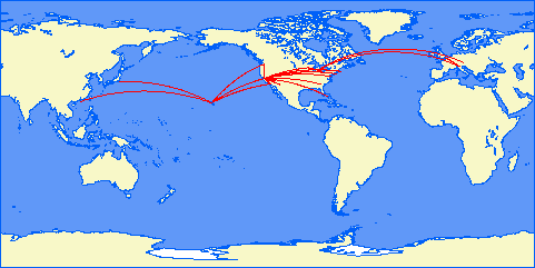
Map courtesy of Patrick Richardson
Click on Pilot's name (if in link format) to see their report.
08/01/99 PHNL Honolulu, HI. PHOG Kahului, HI. A340 I 25.00 36 PHMK Hoolehua, HI. PHNL Honolulu, HI. Canadair Reg J I 15.00 54 PHNL Honolulu, HI. PHMK Hoolehua, HI. Canadair Reg J I 15.00 55 PHNL Honolulu, HI. PHNY Lanai City, HI. Canadair Reg J I 20.00 72 PHNL Honolulu, HI. PHLI Lihue, HI. A340 I 25.00 80 PHLI Lihue, HI. PHNL Honolulu, HI. A340 I 25.00 81 PHNL Honolulu, HI. PHLI Lihue, HI. A340 I 25.00 82 PHLI Lihue, HI. PHNL Honolulu, HI. A340 I 25.00 83 PHNL Honolulu, HI. PHLI Lihue, HI. A340 I 25.00 84 PHLI Lihue, HI. PHNL Honolulu, HI. A340 I 25.00 85 PHNL Honolulu, HI. PHLI Lihue, HI. A340 I 25.00 86 PHLI Lihue, HI. PHNL Honolulu, HI. A340 I 25.00 87 PHNL Honolulu, HI. PHLI Lihue, HI. A340 I 25.00 88 PHKO Kona, HI. PHOG Kahului, HI. A340 I 20.00 96 PHOG Kahului, HI. PHKO Kona, HI. A340 I 20.00 97 PHKO Kona, HI. PHTO Hilo, HI. A340 I 18.00 98 PHTO Hilo, HI. PHKO Kona, HI. A340 I 20.00 99 PHKO Kona, HI. PHTO Hilo, HI. Canadair Reg J I 45.00 100 PHTO Hilo, HI. PHKO Kona, HI. Canadair Reg J I 45.00 101 KSYR Syracuse KJFK New York, NY. (JFK) I 20.00 308 KMIA Miami, FL. KPBI Palm Beach, FL. 737 I 20.00 404 KPBI Palm Beach, FL. KMIA Miami, FL. 737 I 20.00 405 KORD Chicago, IL. (O'Hare) KDTW Detroit, MI. A340 I 60.00 502 KDTW Detroit, MI. KMIA Miami, FL. A340 I 65.00 503 KMIA Miami, FL. Nassau, Bahamas Canadair Reg J V 50.00 622 KMIA Miami, FL. GCM Grand Cayman A340 I 80.00 624 Papeete Moorea Canadair Reg J V 12.00 701 Moorea Papeete Canadair Reg J V 12.00 702 Papeete Moorea Canadair Reg J V 15.00 705 Moorea Papeete Canadair Reg J V 15.00 706 Papeete Bora Bora Canadair Reg J V 50.00 707 Papeete Maupiti Canadair Reg J V 55.00 715 Maupiti Bora Bora Canadair Reg J V 55.00 716 Bora Bora Huahine Canadair Reg J V 30.00 719 Huahine Bora Bora Canadair Reg J V 30.00 720 Bora Bora Maupiti Canadair Reg J V 15.00 723 Bora Bora Rangiroa Canadair Reg J V 45.00 725 Papeete Matavia Canadair Reg J V 120.00 727 Matavia Papeete Canadair Reg J V 110.00 728 39 segments 22hrs 27 min 1347.00
First tour of French Polynesia. Outstanding scenery. Breath taking.
Thanks Bruno. Wish I could be there in person and see FP.
Lihue as usual has difficult weather.
OGG continues to have the highest windshear incidence I have seen.
Glad to be with all you great pilots. You make this airline a
joy to be in.
HI105 Lihue HNL Lanai 24 + 21 min
HI89 HNL Lihue 31min
HI604 JFK MUC 7 h 18 min
Had no Canadair Jet for ver. 5.02, therefore used a 737.
, #of Hours:8:34, Problems:, Sorry for being late - I was up in Hamburg for the last three weeks. As I told you I changed job in mid of August.
SB
PS Send you another mail soon. checking out FLY
Flights:
HI 003 PHNL - PHTO 47 min B757-300
HI 302 KJFK - KDCA 36 min MD82
KTMP - KMIA 33min Airbus A320-200, #of Hours: 1.7
Flight Segments:2
My FIRST flight with HI, hope I filled in the form correctly!!!
Ashley Cripps, Reporting for what month:August, Today's Date:14 august, Flights:HI 653, LFPG-LSGG 43 mins, LSGG-LIMC 34 mins, B757-300
HI 655, LFMN-LEBL 45 mins, LEBL-LIMC 1hr 5 mins, B767-200ER, #of Hours:2hr 57 mins, Problems:NONE, HI 655 flown 11 august, not too many people because of the eclipse in Europe.
Flight Segments:2
HI 680 Frankfurt-Munich 35 mins
HI 657 LIRF - LIMC 46 mins
HI 687 EKCH - EDDM 1 hr 7 mins
, #of Hours:2.28, Problems:Anti ice system failure, Submit
---------------------------------------------------------------------------
(Flight Segment) Flight Segments:3
Flight report for August 1999
HI12 Honolulu Kona B-747-400 30 min 150NM. I used this plane instead of the standard 757, to test the new panel: it's very nice. The beast is heavy and I did some confusion during approach, but a perfect landing resulted, I think this is the fall-out of PS1 training!
HI 70 Honolulu Lanai ATR-42 23 min 79 NM. Take from runway 08R, cruise at 7000ft on airway V2, then DME arc approach to runway 03 at Lanay. A very good IFR and airplane handling exercise, I like it. This time I asked for some help to the autopilot, to maintain 2000ft while performing the DME arc.
HI 104 Hilo Honolulu B-757 37 min 221 NM. Very nice IFR flight, Paris Two departure from Hilo then airway V16 and LDA "angled" approach followed by perfect landing on runway 26L.
HI 103c Kona Lihue B-747 37 min 242 NM. Night IFR cargo flight, "imperfect" landing for strong wind, but there are no passengers to protest!
HI 183 panoramic Flight ATR-42 29 min 103 NM. Take-off from Kahului, Beach One departure and climb to 5500ft; fly around Kahoolawe, join airway V16 at Lavas intersection, VRF approach and landing on rwy 04 at Waimea.
HI 652 Milan Geneva Paris B-757, 1 hour 10 min, 368 NM. VFR flight to Geneva to evaluate my custom texturing of the Alps, then IFR to Paris at FL 260 with original charts. Annoying winds, but perfect landing on rwy 28.
HI656 Milan Rome Airbus A340 46 min 292 NM. The night was so dark, and the crosswind was so strong and the '340 so heavythat I landed on the taxiway! Instead of rwy 16L after a correct approach. In true life 16L is closed for works, and the taxiway is used as rwy16C, BUT this was not my intention. As I repeat this error frequently (wrong landing after a perfect approach) I suspect that I need rudder pedals.
HI 703 Tahiti Moorea Dash-8 Q400, 6 min, 15NM. First flight in french Polinesia, short but I was so excited that I landed in Moorea only after three attempts.
HI 704 Moorea Tahiti Dash-8 Q400, 12 min, 37 NM. Flight included a sight-seeing trip around Moorea.
HI 709 Tahiti Bora Bora Dash-8 Q400 34 min, 143 NM. IFR flight via Huahine VOR, NDB approach and landing.
HI 710 Bora Bora Tahiti ATR-42 40 min 161 NM. Flight level 150, route via Raiatea NDB and fly over Maiao.
HI 717 Bora Bora Maupiti ATR-42 11 min 30 NM. Direct flight.
HI 718 Maupiti Bora Bora ATR-42 20 min 68 NM. With panoramic flights around Maupiti, Tupai and Bora Bora, at passengers' request.
HI 721 Bora Bora Tahaa Hu-16, 15 min. Take from runway 11, cruise at 3000ft, followed the reef around Tahaa, then landed in Haamene bay.
HI 722 Tahaa Bora Bora HU-16 8 min. Take off from Haamene bay, fly over Taira pass and Hurepiti bay, then heading 290 while climbing at 3000ft. Panoramic descent around Bora Bora's east coast, then landed on rwy 11. Two short but exilarating flights.
HI 724 Maupiti Tahiti Dash-8 Q400 48 min 178 NM. The wonderful "sunset flight" with stops in all the enroute airports: Bora Bora, Raiatea, Huahine and Moorea. Fantastic.
No of flights: 16, no of segments: 21; time flown 7 hours 46 minutes.
No problems.
Dep Arv in Flt TTl
01-Aug-99 HI303 B737 KDCA KJFK 12:21 13:00 00:39 00:39
01-Aug-99 HI304 B737 KJFK KPIT 13:30 14:21 00:51 00:51
01-Aug-99 HI305 B737 KPIT KJFK 14:07 14:59 00:52 00:52
01-Aug-99 HI400 EMB120 KMIA KRSW 13:06 13:31 00:25 00:25
01-Aug-99 HI401 EMB120 KRSW KMIA 16:57 17:23 00:26 00:26
01-Aug-99 HI402 MD80 KMIA KMCO 12:23 12:54 00:31 00:31
01-Aug-99 HI403 MD80 KMCO KMIA 20:17 20:55 00:38 00:38
01-Aug-99 HI410 EMB120 KMIA KMTH 11:24 11:48 00:24
01-Aug-99 HI410 EMB120 KMTH KEYW 12:27 12:44 00:17 00:41 05:03, #of Hours:5:03, Problems:, Submit
---------------------------------------------------------------------------
(Flight Segment) Flight Segments:8
Total IFR Flight
Time: 9 hrs. : 49 min. Total VFR Flight
Time: 3 hrs. : 20 min. Total Flight
Time: 13 hrs. : 9 min. HIA Flight Legs: 18 IFR/ Duration: Date: Day: From: City: To: City: Aircraft: VFR (Hrs.) HIA Flight: 8/3/99 Tuesday PHNL Honolulu, HI.
(International) PHMK Kaunakakai/Hoolehua,
HI. ATR-42 V 0.55 HI52 8/3/99 Tuesday PHMK Kaunakakai/Hoolehua,
HI. PHNL Honolulu, HI.
(International) ATR-42 I 0.60 HI53 8/4/99 Wednesday PHNL Honolulu, HI.
(International) PHLI Lihue, HI. Dash-8 I 0.55 HI102 8/4/99 Wednesday PHLI Lihue, HI. PHNL Honolulu, HI.
(International) Dash-8 I 0.60 HI103 8/13/99 Friday PHTO Hilo, HI. PHKO Kona, HI. Canadair I 0.42 HI106 8/13/99 Friday PHKO Kona, HI. PHNY Lanai City, HI. Canadair V 0.42 " 8/13/99 Friday PHNY Lanai City, HI. PHKO Kona, HI. Canadair I 0.50 HI107 8/17/99 Tuesday PHKO Kona, HI. PHTO Hilo, HI. Canadair V 0.48 " 8/18/99 Wednesday PHNY Lanai City, HI. PHNL Honolulu, HI.
(International) ATR-42 I 0.55 HI71 8/18/99 Wednesday PHNY Lanai City, HI. PHOG Kahului, HI. ATR-42 I 0.40 HI73 8/18/99 Wednesday PHOG Kahului, HI. PHNL Honolulu, HI.
(International) ATR-42 I 0.68 " 8/22/99 Sunday PHNL Honolulu, HI.
(International) PHHN Hana/Maui, HI. Dash-8 V 0.63 HI42 8/22/99 Sunday PHHN Hana/Maui, HI. PHNL Honolulu, HI.
(International) Dash-8 I 0.77 HI43 8/25/99 Wednesday PHTO Hilo, HI. PHNL Honolulu, HI.
(International) Boeing 737 I 0.88 HI08 8/25/99 Wednesday PHNL Honolulu, HI.
(International) PHTO Hilo, HI. Boeing 737 I 0.82 HI09 8/29/99 Sunday KLGA New York, NY. (La
Guardia) KPHL Philadelphia, PA.
(International) EMB-145 I 0.45 HI306 8/29/99 Sunday KPHL Philadelphia, PA.
(International) KLGA New York, NY. (La
Guardia) EMB-145 V 0.53 HI307 8/30/99 Monday KEYW Key West, FL.
(International) KMIA Miami, FL.
(International) ATR-42 I 0.67 HI408 8/30/99 Monday KMIA Miami, FL.
(International) KEYW Key West, FL.
(International) ATR-42 V 0.72 HI409 8/31/99 Tuesday KMIA Miami, FL.
(International) KJAX Jacksonville, FL. Airbus A-320 I 0.97 HI414 8/31/99 Tuesday KJAX Jacksonville, FL. KMIA Miami, FL.
(International) Airbus A-320 I 0.98 HI415
HI101c HKO-HTO 21 min
HI102c HTO-HKO 18 min
HI103c HKO-HLI 59 min
HI104c HLI-HKO 1 hr 15 min
HI105c HKO-HNY 26 min
HI106c HNY-HKO 18 min
HI107c HKO-HOG 22 min
HI108c HOG-HKO 20 min
HI109c HKO-HMK 38 min
HI110c HMK-HKO 31 min
HI111c HNL-HKO 33 min
HI112c HKO-HNL 28 min
HI200c HKO-MDY 2 Hrs 47 min
HI201c MDY-HKO 2 Hrs 35 min, #of Hours: 11 Hrs 51 min, Problems:
HI104c HLI-HKO 1 hr 15 min My ailerons and elevators and rudders failed due to a massive hydrolic failure (actually my control yoke stopped working in midflight so I decided to call it a massive hydrolic failure) All I had left to fly the aircraft with was differential engine thrust.I diverted to Honolulu after flying circles for about an hour between HLI and HNL. I barely managed to land it, I touched down on at about 255 kts and 4000 ft down the runway (runway 8L) and I wasn't able to get the left main gear on the runway. I reversed thrust as soon as I was on the ground and applied full breaking. I stopped about 500 ft from the end of the runway. This deffinately wasn't the best landing of my career, but I was surprised that I put it on the runway in the first place. No passengers or crew members were injured. The aircraft sustained severe damage to the left main landing gear and a small amount of damage to the nose wheel and right main gear due to the hard (and fast) landin!
LIGHT HI300 NEW YORK (KJFK) TO BOSTON (KBOS)
Take off at 1700 and at the ramp at Boston at 1745
Total time 45 minutes
Aircraft 737, fuel used 3272 lbs, distance 160 miles
Lost slats early in flight and ILS seemed to malfunction on landing otherwise all OK
FLIGHT HI301 BOSTON (KBOS) TO NEW YORK (KJFK)
Take off at 1900 and at the ramp at New York at 1940
Total time 40 minutes
Aircraft 737, fuel used 3262 lbs, distance 160 miles
This flight seems to have problems!
Lost the HSI on final approach, although the ILS seemed to be still working, then on landing lost hydraulics,
but all were safe as we were then down on terra firma.
FLIGHT HI180 KONA (PHKO) TO KONA
Sightseeing visiting Volcano National Park and Kilavae Crater
Take off 1200 and landed at Kona at 1255
Total time 55 minutes
Aircraft ATR42, fuel used 3481 lbs, distance covered 196 miles
No problems on this flight. All, including the pilot, enjoyed the run.
FLIGHT HI01 HONOLULU (PHNL) TO HILO (PHTO)
Take off 0630 and at the ramp at Hilo at 0713
Total time 43 minutes
Aircraft 737, fuel used 3899 lbs, distance 189 miles
No problems
FLIGHT HI02 HILO (PHTO) TO HONOLULU (PHNL)
Take off 0730 and at the landed at Honolulu at 0816
Total time 46 minutes
Aircraft 737, fuel used 4311 lbs, distance 189 miles
A difficult flight. High winds at Honolulu made landing difficult.
Also right gear malfunction meant I had to land as slowly as possible, added to which I lost the HSI with all information on final approach.
Luckily the ILS still worked, so landed on 04R safely but with a list to the right.
Managed to move aircraft off runway where it will need a tow for repair.
HI185 HONOLULU (PHNL) SIGHTSEEING &endash; Pearl Harbour, Makaha (SW),
Kahuku Point (north tip), Mokapu peninsula, Mokapu Head, Diamond Head
Take off 0930 and at the ramp on return at 1021
Total time 51 minutes
Aircraft Dash, fuel used 1925 lbs
A very enjoyable flight. Sorry for extra time and fuel used, had to go around again for landing due to strong wind. Landed on 08L.
HI682 MUNICH (EDDM) TO AMSTERDAM (EHAM)
Take off 1900 and at the ramp at Amsterdam at 2039
Total time 1 hour 39 minutes
Aircraft Airbus 340, fuel used 35371 lbs, distance 370 miles.
Problems on this flight. Lost the fuel flow to number three engine early on,
continued as all was well. ATC gave completely wrong instructions (thank you Austin) and I had to abort the landing and go around again,
being taken all over the place (I think they forgot me) before being brought in on the ILS miles away. Took over manually and landed eventually.
HI683 AMSTERDAM (EHAM) TO MUNICH (EDDM)
Take off 2130 and at the ramp at 2245
Total time 1 hour 15 minutes
Aircraft Airbus 340, fuel used 30972 lbs, distance 370 miles
No problems
HI92 LIHUE (PHLI) TO HILO (PHTO)
Take off 0900 and at the ramp at Hilo at 0952
Total time 52 minutes
Aircraft 757, fuel used 10733 lbs, distance 278 miles
Lost flaps during the flight but landed safely albeit at a higher speed than I would have chosen
HI93 HILO (PHTO) TO LIHUE (PHLI)
Take off at 1030 and at the ramp at Lihue at 1118
Total time 48 minutes
Aircraft 757, fuel used 10200 lbs, distance 278 miles
No problems
HI94 LIHUE (PHLI) TO KONA (PHKO)
Take off at 2000 and at the ramp at Kona at 2042
Total time 42 minutes
Aircraft 757, fuel used 9273 lbs, distance 230 miles
Right gear problem reported, but landed safely
HI95 KONA (PHKO) TO LIHUE (PHLI)
Take off at 2130 and at the ramp at Lihue at 2213
Total time 43 minutes
Aircraft 757, fuel used 8423 lbs, distance 230 miles
No problems
Barrie Myers
TOTAL FLYING HOURS FOR AUGUST
10 hours 39 minutes
Excused from Reporting this month.
Flights:
HI454 KSFO-KSAN MD-80 1hr22min
H482 KDTW-KMSP DC-10 1hr21min KMSP-KSFO DC-10 3hr25min
HI602 KJFK-EDDM 747-400 7hr1min, #of Hours:13hr10min, Problems:, Submit
Flight Segments:4
FLIGHT FROM TO AIRCRAFT ALTITUDE DISTANCE TIME VIND VTRU PASS. FUEL DEP. FUEL ARR. NOTES
HI220 HONOLULU TAHITI B747 33000 2381 4:45 320 562 66000 290000 126000
HI 221 TAHITI HONOLULU B747 35000 2381 4:40 304 543 66494 290000 122430
HI453 LOS ANGELES SAN FRANCISCO A320 24000 294 0:55 340 560 34520 22027 14686
HI501 CHICAGO BOSTON B767 33000 749 1:59 298 518 53427 121875 85746 Heavy rain, overcast 5000
HI601 MILAN NEW YORK A340 35000 4182 8:41 285 510 33012 187347 77871
HI660 MILAN ATHENES A320 29000 857 2:11 335 590 34520 31962 13231 Strong winds enroute
HI608 SAN FRANCISCO TORONTO B777 33000 1883 4:21 296 516 26285 208630 110110 Winds at 60kt in some points
HI 726 RANGIROA BORA BORA ATR42 20000 256 1:09 200 280 Overcast 1600
FLIGHT FROM TO AIRCRAFT ALTITUDE DISTANCE TIME VIND VTRU PASS. FUEL DEP. FUEL ARR. NOTES
HI620 MIAMI NASSAU B737 15000 159 0:45 300 385 16190 12660 5641
HI629 GUANTANAMO BAY MIAMI A320 31000 481 1:15 311 521 34520 22291 12205
HI637 CARACAS MIAMI A340 35000 1360 4:10 285 515 66025 155322 103604 Incl. 1 hour stop at Bonaire
HI714 MAUPITI PAPETE DASH-8 15000 170 0:56 241 308 6950 13396 5226
HI04 PHTO-PHNL Boeing 737 38min
HI305 KPIT-KJFK Boeing 737 51min
HI330 KJFK-KSFO Boeing 767 4h 40min
HI626 MYNN-KMIA Boeing 737 40min
HI632 KMIA-MKJP Boeing 737 1h 15min
HI633 MKJP-KMIA Boeing 737 1h 19min
HI636 KMIA-TNCB Boeing 737 2h 24min, TNCB-SVMI Boeing 737 0h 26min
#of Hours: 12.2 hours, Problems:
HI636 Strong winds at Bonaire (TNCB). It was a hard to land but I take the 737 saftey to the runway., Hello Reza!
Flight Segments: 7
Albert Tanneberg, August 1999, August 31st 1999, Flight HI201
# Type: Name: Frequency: Course: Dist.: Time:
-------------------------------------------------------------------
Depart: --> San Francisco International KSFO 0 NM 13:00
WX: Skies 700 Scattered VIS 10 Wind 300 AT 11
Arrive: --> Honolulu International PHNL 2084 NM 17:33
WX: Skies clear VIS 20 Wind 350 AT 5
===================================================================
Aircraft: Boeing 747-400
Cruise: 480 knots, maximum range 10680 NM
Climb: 300 knots at 2200 ft/min (19 min, 95 NM)
Descend: 380 knots at 1800 ft/min (23 min, 146 NM)
===================================================================
1 Depart: San Francisco International KSFO 0 NM 13:00
--> Climb to 41000 feet.
2 Waypoint: BAART ISEC 254° 229 NM 13:36
3 Waypoint: BLUFF ISEC 250° 140 NM 13:54
4 Waypoint: BAKON ISEC 249° 299 NM 14:31
5 Waypoint: BILLO ISEC 245° 342 NM 15:14
6 Waypoint: BEATS ISEC 242° 257 NM 15:46
7 Waypoint: BANDY ISEC 240° 300 NM 16:24
8 Waypoint: BRADR ISEC 238° 219 NM 16:51
9 Waypoint: MAGGI ISEC 227° 236 NM 17:23
10 Waypoint: Kaneohe Bay NDB : 265.0 242° 50 NM 17:31
-------------------------------------------------------------------
11 Arrive: Honolulu International PHNL 230° 12 NM 17:33
Runway heading 42°
===================================================================
Total: (15597 gallons fuel required) 2084 NM 04:33
Flight HI203
# Type: Name: Frequency: Course: Dist.: Time:
-------------------------------------------------------------------
Depart: --> Honolulu International PHNL 0 NM 08:00
WX: Skies clear VIS 20 Wind 320 AT 12
Arrive: --> Los Angeles Intl. - Rwy 25R 2237 NM 12:51
WX: Skies 400 Scattered VIS 6 Haze Wind 240 AT 5
===================================================================
Aircraft: Boeing 747-400
Cruise: 480 knots, maximum range 10680 NM
Climb: 300 knots at 2200 ft/min (19 min, 95 NM)
Descend: 380 knots at 1800 ft/min (23 min, 146 NM)
===================================================================
1 Depart: Honolulu International PHNL 0 NM 08:00
--> Climb to 41000 feet.
2 Waypoint: Kaneohe Bay NDB : 265.0 50° 12 NM 08:02
3 Waypoint: MAGGI ISEC 62° 50 NM 08:12
4 Waypoint: CLUTS ISEC 61° 146 NM 08:32
5 Waypoint: CLURE ISEC 56° 100 NM 08:44
6 Waypoint: CHEAK ISEC 57° 206 NM 09:10
7 Waypoint: CITTA ISEC 58° 300 NM 09:48
8 Waypoint: FLEXX ISEC 67° 267 NM 10:21
9 Waypoint: FEZEK ISEC 69° 337 NM 11:03
10 Waypoint: HARRD ISEC 72° 300 NM 11:41
11 Waypoint: GALIP ISEC 75° 185 NM 12:04
12 Waypoint: Gaviota [GVO] VOR : 113.80 80° 242 NM 12:36
-------------------------------------------------------------------
13 Arrive: Los Angeles Intl. - Rwy 25R 112° 92 NM 12:51
Runway heading 249°
===================================================================
Total: (16707 gallons fuel required) 2237 NM 04:51
Flight HI504
# Type: Name: Frequency: Course: Dist.: Time:
-------------------------------------------------------------------
Depart: --> Los Angeles Intl. - Rwy 25R 0 NM 20:00
WX: Skies 400 Scattered VIS 6 Haze Wind 240 AT 5
Arrive: --> O'hare Intl - Rwy 27R 1520 NM 23:27
WX: Skies 6000 Scattered VIS 10 Wind 20 AT 9 GUST 14
===================================================================
Aircraft: Boeing 757-200
Cruise: 460 knots, maximum range 6640 NM
Climb: 300 knots at 2500 ft/min (16 min, 80 NM)
Descend: 300 knots at 3000 ft/min (13 min, 65 NM)
===================================================================
1 Depart: Los Angeles Intl. - Rwy 25R 0 NM 20:00
--> Climb to 39000 feet.
2 Waypoint: Pomona [POM] VOR : 110.40 74° 31 NM 20:06
3 Waypoint: Hector [HEC] VOR : 112.70 56° 78 NM 20:19
4 Waypoint: Goffs [GFS] VOR : 114.40 72° 66 NM 20:28
5 Waypoint: Peach Springs[PGS] VOR : 112.00 69° 85 NM 20:39
6 Waypoint: Grand Canyon [GCN] VOR : 113.10 73° 71 NM 20:48
7 Waypoint: Tuba City [TBC] VOR : 113.50 77° 44 NM 20:54
8 Waypoint: Durango [DRO] VOR : 108.20 69° 180 NM 21:17
9 Waypoint: Pueblo [PUB] VOR : 116.70 66° 172 NM 21:39
10 Waypoint: Goodland [GLD] VOR : 115.10 62° 144 NM 21:58
11 Waypoint: Mankato [TKO] VOR : 109.80 80° 161 NM 22:19
12 Waypoint: Pawnee City [PWE] VOR : 112.40 75° 97 NM 22:32
13 Waypoint: Lamoni [LMN] VOR : 116.70 76° 105 NM 22:46
14 Waypoint: Ottumwa [OTM] VOR : 111.60 70° 79 NM 22:56
15 Waypoint: Moline [MZV] VOR : 114.40 77° 78 NM 23:06
-------------------------------------------------------------------
16 Arrive: O'hare Intl - Rwy 27R 71° 129 NM 23:27
Runway heading 271°
===================================================================
Total: (3652 gallons fuel required) 1520 NM 03:27
, 8h 50m, Problems:none, Submit
---------------------------------------------------------------------------
(Flight Segment) 3
This page is part of Hawaiian International VA.