Hawaiian International Flight Reports for June 1999
6.30.99
Hawaiian International Flight Reports for June 1999
Flight Reports are placed here from our famous world class pilots.
They are reported in the order in which I recieve them ie: The first one who files gets the first listing.
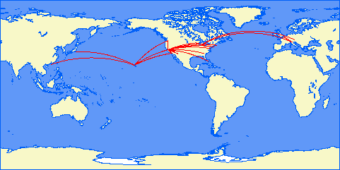
Map courtesy of Patrick Richardson
Click on Pilot's name (if in link format) to see their report.
2 Flights to Lihue roundtrip was 1.5 hours. VFR all the way nice weather. Busy month for me so flight volume was low this month.
Here´s my report for June. Next time earlier.
Flights:HI 686 1h25min
HI 687 1h38min
HI 681 45min
HI 682 1h11min
HI 683 1h15min
of Hours:6h 14 min
Problems:Approch EHAM (HI 682) Wind at 360 30knots. Atis gives me 01L. Wanted to
do a Backcourse 19R (ILS freq 109,5 or so). But that thing didn´t work. I swang over to 01 R
-however the ILS in the Xplane map is labeled 19 something but it is for a 01 direction....have a look and you´ll see
what i mean. Save manual landing.
Flight report for June 1999
HI 680 Munich Frankfurt Dash-8 Q400 47 min. Airways B1 and G104, IFR approach and landing on rwy 07R. Strong winds required heavy use of auto-pilot to maintain route and approach, but touch-down was very smooth.
HI 684 Munich Bruxelles Airbus A320 53 min. Nice IFR flight with authentic charts. No winds.
HI 657 Rome Milan Airbus A340 49 min. Fast cruise at 0.90 Mach, final approach in a storm and landing with poor visibility: I saw the runway when I was on the numbers. Some friends of mine still think that these filghts are boring!
HI 660 Milan Athens Airbus A340 2 hours 2 min. IFR uneventful flight.
HI 42 Honolulu Hana Dash-8 Q400 32 min 124 NM. Back to Hawaii, with brand new plane and textures. Flight on airway V15, at 5000ft to give the passengers breath-taking views over west Ohau, Molokai and Maui, and for me to check the new textures. At Barby intersection descend and VFR approach to Hana. This is a great plane: comfortable, quiet, fast, easy to fly. I love it also because it forgives my low-speed approaches: with everything out, stall is at 84KIAS.
HI 43 Hana Honolulu Dash-8 Q400 30 min 129 NM. Nice flight at FL120, following airways V21-2, with superb views of Maui and Lanai enroute. Approach and landing on runway 26L.
HI 52 Honolulu Molokai ATR-42 33 min 114 NM. Despite "wind light and variable" I found myself in a thunderstorm at Molokai, so I executed a missed approach and headed back to Honolulu, for the usual approach to runway 26L. But, again, despite 4 NM visibility, I didn't see the runway but was able to find at least 26R and land on it. What is Realweather doing?
HI 53 Molokai Honolulu Dash-800 Q100 16 min 53 NM. Test flight of this brand new, hi-tech plane in the ATR-42 class. It's a nice plane to handle, even in the (moderate) wind that I found on my way.
HI 186 Honolulu Place of refuge HU-16 Albatros 57 min 180 NM. IFR flight to Lanai and Kona VOR, at 4000 ft, then descent and perfect sea-landing.
HI 180 Kona Hilo Mountain view Volcano national park Kilauea crater Kona ATR 42 39 min 146 NM. Very nice VFR panoramic flight, with nice (real)weather this time.
HI 97 Kahului Kona MD-87 20 min, 86 NM. Test flight for the MD-87, back to service with ver 5 specs. It's always a fine plane to handle.
HI 184 Waimea fly over Lanai Kahului ATR-42, 40 min, 155 NM. Climb to FL100, cruise on airway V7, over Lanai NDB descend to 3000ft while circling the island, then joined Camps intersection (21,4 NM from LNY VOR on radial 095), and ILS approach to runway 02 at Kahului.
HI 84 Honolulu Lihue Airbus A320 20 min 100 NM. Low ceiling and visibility, and some wind; smooth landing after correct IFR approach.
HI 85 Lihue Honolulu Airbus A320 20 min 93 NM. This is an excellent IFR trainer: with 10 NM visibility, I see the runway when it's 2 NM apart! Should I train for real flying, I think this could be very helpful.
Total flights: 14, segments: 14; time: 9 hours 38 min, some problem with real weather.
The following is my report covering flights flown in June 1999:
Month HI# Type Dep Dest Left Arvd Time TTL
01-Jun-99 HI306 EMB120 KLGA KPHL 14:13 14:49 00:36
01-Jun-99 HI307 EMB120 KPHL KLGA 11:58 12:27 00:29
01-Jun-99 HI402 MD87 KMIA KMCO 12:23 12:58 00:35
01-Jun-99 HI403 MD87 KMCO KMIA 00:15 00:58 00:43
01-Jun-99 HI406 B737 KMIA KTPA 12:10 12:49 00:39
01-Jun-99 HI407 B737 KTPA KMIA 17:19 17:59 00:40
01-Jun-99 HI632 B757 KMIA MKJP 23:21 00:44 01:23
01-Jun-99 HI633 B757 MKJP KMIA 19:02 20:28 01:26 06:31
Total IFR Flight Time: 25 hrs. : 8 min. Total VFR Flight Time: 1 hrs. : 53 min. Total Flight Time: 27 hrs. : 1 min. HIA Flight Legs: 36 IFR/ Duration: Date: Day: From: City: To: City: Aircraft: VFR (Hrs.) HIA Flight: 6/2/99 Wednesday PHNL Honolulu, HI. PHTO Hilo, HI. Boeing 757 I 0.75 HI07 6/2/99 Wednesday PHTO Hilo, HI. PHNL Honolulu, HI. Boeing 757 I 0.72 HI08 6/4/99 Friday PHNL Honolulu, HI. PHKO Kona, HI. Boeing 737 I 0.62 HI14 6/4/99 Friday PHKO Kona, HI. PHNL Honolulu, HI. Boeing 737 I 0.60 HI15 6/4/99 Friday PHKO Kona, HI. PHTO Hilo, HI. Boeing 747 I 0.45 HI101c 6/4/99 Friday PHTO Hilo, HI. PHKO Kona, HI. Boeing 747 I 0.53 HI102c 6/5/99 Saturday PHKO Kona, HI. PHLI Lihue, HI. Boeing 747 I 0.92 HI103c 6/5/99 Saturday PHLI Lihue, HI. PHKO Kona, HI. Boeing 747 I 0.83 HI104c 6/5/99 Saturday KMIA Miami, FL. KPBI Palm Beach, FL. Airbus A-320 I 0.38 HI404 6/5/99 Saturday KPBI Palm Beach, FL. KMIA Miami, FL. Airbus A-320 I 0.38 HI405 6/5/99 Saturday KMIA Miami, FL. KDAB Daytona Beach, FL. Airbus A-320 I 0.75 HI412 6/5/99 Saturday KDAB Daytona Beach, FL. KMIA Miami, FL. Airbus A-320 I 0.72 HI413 6/6/99 Sunday KMIA Miami, FL. KJAX Jacksonville, FL. Airbus A-320 I 0.83 HI414 6/6/99 Sunday KJAX Jacksonville, FL. KMIA Miami, FL. Airbus A-320 I 0.90 HI415 6/8/99 Tuesday PHNL Honolulu, HI. PHMK Kaunakakai/Hoolehua, HI. Saab-2000 V 0.38 HI40 6/8/99 Tuesday PHMK Kaunakakai/Hoolehua, HI. PHHN Hana/Maui, HI. Saab-2000 V 0.43 HI41 6/9/99 Wednesday KLGA New York, NY. (Laguardia) KHFD Hartfort, CT. ATR-42 V 0.50 HI322 6/9/99 Wednesday KHFD Hartfort, CT. KLGA New York, NY. (Laguardia) ATR-42 V 0.57 HI323 6/16/99 Wednesday KJFK New York, NY. (JFK) KDCA Washington, D.C. (National) Boeing 737 I 0.77 HI302 6/18/99 Friday KLGA New York, NY. (Laguardia) KPIT Pittsburgh, PA. Boeing 737 I 1.05 HI304 6/18/99 Friday KPIT Pittsburgh, PA. KLGA New York, NY. (Laguardia) Boeing 737 I 0.92 HI305 6/18/99 Friday KSYR Syracuse, NY. KJFK New York, NY. (JFK) Boeing 737 I 0.78 HI308 6/18/99 Friday KJFK New York, NY. (JFK) KSYR Syracuse, NY. Boeing 737 I 0.67 HI309 6/22/99 Tuesday KJFK New York, NY. (JFK) KPWM Portland, ME. MD-82 I 0.90 HI320 6/22/99 Tuesday KPWM Portland, ME. KJFK New York, NY. (JFK) MD-82 I 0.93 HI321 6/28/99 Monday KDTW Detroit, MI. KLGA New York, NY. (Laguardia) Boeing 767 I 1.55 HI325 6/28/99 Monday KSFO San Fransisco, CA. KLAX Los Angeles, CA. Airbus A-320 I 0.87 HI452 6/28/99 Monday KLAX Los Angeles, CA. KSFO San Fransisco, CA. Airbus A-320 I 0.92 HI453 6/29/99 Tuesday KIAD Washington, D.C. (Dulles) KORD Chicago, IL. (O'Hare) Airbus A-340 I 1.75 HI508 6/29/99 Tuesday KORD Chicago, IL. (O'Hare) KIAD Washington, D.C. (Dulles) Airbus A-340 I 1.65 HI509 6/30/99 Wednesday PHNL Honolulu, HI. PHLI Lihue, HI. Boeing 757 I 0.43 HI82 6/30/99 Wednesday PHLI Lihue, HI. PHNL Honolulu, HI. Boeing 757 I 0.38 HI83 6/30/99 Wednesday PHNL Honolulu, HI. PHKO Kona, HI. Boeing 737 I 0.60 HI16 6/30/99 Wednesday PHKO Kona, HI. PHNL Honolulu, HI. Boeing 737 I 0.58 HI17 6/30/99 Wednesday PHNL Honolulu, HI. PHOG Kahului, HI. Boeing 767 I 0.47 HI30 6/30/99 Wednesday PHOG Kahului, HI. PHNL Honolulu, HI. Boeing 767 I 0.53 HI31
6-29-99
HI101 HNL-SFO 4:22
Very Smooth
HI102 SFO-HNL 1:34 engines 1 and 4 failed about 5 seconds after V2, I slowly
climbed up to 10,000 feet and headed out over the ocean. I proceeded to dump
51,840 gallons of jet fuel (I think thats over $100,000 worth of fuel, SORRY
REZA, I had no choice) to get my aircraft below Max Landing Weight. I flew
out over the ocean for an hour then I closed the fuel valves and flew back to
KSFO and made an approach with visibility of about 1/16 of a mile and a very
slight crosswind. I set it down right on the numbers and taxied back to the
gate and shut down.
HI103 HNL-LAX 4:35
Very Smooth
HI101c HNL-MDY 3:53 When I reached Midway I recieved the ATIS broadcast and
it stated the there was a 63 kt wind. I wasn't to excited about having to
make a landing in a 63 kt wind so I circled over Midway at 15,000 ft for a
half an hour hoping the weather would improve. The wind didn't get any
lighter but it did change directions and now I had a direct headwind so I
decided to land. I descended and made a difficult approach in the 60 kt
headwind, the approach was pretty smooth till I got down to 2000 ft, there I
encountered some severe windshear. It was rather bumpy from there on down but
I was able to make a pretty nice landing. As soon as I was on the ground I
discovered that the landing was the easy part. It took me 45 minutes to get
my 747 a little over 3000 ft to the ramp (good thing I'm a patient person (o:
). I finally got it to the ramp and shut down.
HI102c MDY-HNL 2:45
Very Smooth
Number of Flights Flown: 5
Total Flight Time: 17:09
FLIGHT HI300 NEW YORK (KJFK) TO BOSTON LOGAN (KBOS)
Take off at 2200 and at the ramp at Boston at 2237
Total time was 37 minutes
Aircraft used was a 737, fuel used 3879 lbs and distance travelled was 170 miles
No problems, apart from storm when taking off and landing.
FLIGHT HI301 BOSTON LOGAN (KBOS) TO NEW YORK (KJFK)
Take off at 0000 and at the ramp at New York at 0048
Total time 48 minutes
Aircraft was a 737, fuel used 4510 lbs and distance travelled was 170 miles
Had to abort landing and go around again. ATC instructions for wrong runway! On go around lost oil pressure in number two engine, but landed safely on 04L. Repairs needed on the engine.
FLIGHT HI191 HONOLULU (PHNL) TO LIHUE (PHLI)
overflying Pearl Harbour, Princeville, Island of Niihau
Take off 1500 and landed at Lihue at 1602
Total time 1 hour and 2 minutes
Aircraft EMB, fuel used 1745 lbs and distance travelled was 232 miles
A pleasant flight in good weather, marred only by a left gear failure warning light. Landed very slowly and gingerly at Lihue but left gear collapsed. No damage to aircraft or passengers, in fact I think that most enjoyed the experience. Repairs to be completed at Lihue before the aircraft can be used again. Parts need to be flown out.
FLIGHT HI192 LIHUE (PHLI) TO HONOLULU (PHNL)
overflying Princeville, Island of Niihau, Pearl Harbour
Take off time 1800 and at the ramp at Honolulu at 1858
Total time 58 minutes.
Aircraft EMB, fuel used 1743 lbs and distance travelled was 255 miles
Very nice flight, good visibility and landed in fairly strong winds at Honolulu. Had to use a different aircraft as the other EMB was having the left gear repaired, see previous flight report.
FLIGHT HI74 HONOLULU (PHNL) TO LANAI (PHNY)
Take off time 1800 and at the ramp at 1835
Total time 35 minutes
Aircraft Gulfstream, fuel used 2022 lbs and distance was 65 miles
Aborted first landing due to strong winds, went round again, and this time landed OK but almost ran out of runway.
FLIGHT HI75 LANAI (PHNY) TO HONOLULU (PHNL)
Take off time 2100 and at the ramp at 2126
Total time 26 minutes
Aircraft Gulfstream, fuel used 1610 lbs, distance 65 miles
No problems, as shown by shorter trip than outward bound
FLIGHT HI03 HONOLULU (PHNL) TO HILO (PHTO)
Take off time 1200 and at the ramp at 1238
Total time 38 minutes
Aircraft 737, fuel used 3758 lbs, distance 189 miles
No problems except rudder malfunction which caused no trouble.
FLIGHT HI04 HILO (PHTO) TO HONOLULU (PHNL)
Take off time 1300 and at the ramp at Honolulu at 1350
Total time 50 minutes
Aircraft 737, fuel used 4673 lbs, distance 189 miles
No problems except ATC instructions at Honolulu. These are always wrong. Maybe I should update my nav dat for the island
Barrie Myers
TOTAL FLYING HOURS FOR JUNE
5 hours 54 minutes
Name:Kay Nemoto, Reporting for what month:June, Today's Date:June 25, 1999, Flights:
HI88 B737 HNL-LIH 0:26
HI89 B737 LIH-HNL 0:31
HI10 B757 HNL-KOA 0:33
HI11 B757 KOA-HNL 0:32
HI05 B737 HNL-ITO 0:39
HI06 B737 ITO-HNL 0:43, #of Hours:3:19, Problems:
---------------------------------------------------------------------------
(Flight Segment) Flight Segments:6
here is my flight report for june.
HI90 PHNL-PKOA 42min strong headwind
HI510 Madison-KORD 38min
HI611 CYZZ-KJFK 1hr 32min crashed on first attempt so had to redo
the flight
2hrs48min 3 segemnts flown
Flight: HI09 Aircraft: B737
--------------------------------------------------------------------------------
Depart: --> Honolulu International PHNL 0 NM 22:00
WX: Scattered 2900 VIS 10 Wind Light+variable
Arrive: --> Hilo International PHTO 188 NM 22:40
WX: Broken 4900 VIS 10 Wind Light+variable
================================================================================
Aircraft: Boeing 737-300
Cruise: 440 knots, maximum range 3470 NM
Climb: 300 knots at 2500 ft/min (7 min, 35 NM)
Descend: 300 knots at 3000 ft/min (6 min, 30 NM)
================================================================================
1 Depart: Honolulu International PHNL 0 NM 22:00
--> Climb to 18000 feet.
2 Waypoint: Koko Head VOR [CKH] VOR : 113.90 107° 12 NM 22:03
3 Waypoint: Lanai VOR [LNY] VOR : 117.70 126° 51 NM 22:15
4 Waypoint: Upolu Point VOR [UPP] VOR : 112.30 118° 72 NM 22:29
--------------------------------------------------------------------------------
5 Arrive: Hilo International PHTO 123° 53 NM 22:40
Runway heading 30°, altitude 38 ft
================================================================================
Total: 188 NM 00:40
______________________________________________________________________
______________________________________________________________________
Flight: HI106 Aircraft: Canadair
--------------------------------------------------------------------------------
Depart: --> Hilo International PHTO 0 NM 22:00
WX: Broken 4900 VIS 10 Wind Light+variable
Arrive: --> Lanai City PHNY 139 NM 22:28
WX: Broken 2000 VIS 20 Wind 230 at 5
================================================================================
Aircraft: Canadair Rj 100
Cruise: 424 knots, maximum range 3700 NM
Climb: 400 knots at 2000 ft/min (9 min, 60 NM)
Descend: 424 knots at 1800 ft/min (10 min, 71 NM)
================================================================================
1 Depart: Hilo International PHNL 0 NM 22:00
--> Climb to 18000 feet.
2 Waypoint: Upolu Point VOR [UPP] VOR : 112.30 118° 72 NM 22:20
--------------------------------------------------------------------------------
3 Arrive: Lanai City PHTO 123° 53 NM 22:28
Runway heading 30°, altitude 38 ft
================================================================================
Total: 139 NM 00:28
______________________________________________________________________
______________________________________________________________________
Flight: HI106c Aircraft: B767
--------------------------------------------------------------------------------
Depart: --> Lanai City PHNY 139 NM 23:30
WX: Broken 2000 VIS 20 Wind 230 at 5
Arrive: --> Hilo International PHTO 0 NM 00:10
WX: Broken 4900 VIS 10 Wind Light+variable
================================================================================
Aircraft: B767
Cruise: 440 knots, maximum range 3700 NM
Climb: 400 knots at 2000 ft/min (9 min, 60 NM)
Descend: 424 knots at 1800 ft/min (10 min, 71 NM)
================================================================================
1 Depart: Lanai City PHNY 0 NM 23:30
--> Climb to 18000 feet.
2 Waypoint: Upolu Point VOR [UPP] VOR : 112.30 118° 72 NM 23:50
--------------------------------------------------------------------------------
3 Arrive: Hilo International PHTO 123° 53 NM 00:10
Runway heading 30°, altitude 38 ft
================================================================================
Total: 139 NM 01:10
______________________________________________________________________
______________________________________________________________________
Flight HI98 B757
Depart: --> Kailua-Kona Keahole-Kona Inte PHKO 0 NM 06:40
Arrive: --> Hilo International PHTO 56 NM 06:57
================================================================================
Aircraft: Boeing 757-200
Cruise: 460 knots, maximum range 6640 NM
Climb: 300 knots at 2500 ft/min (3 min, 15 NM)
Descend: 300 knots at 3000 ft/min (3 min, 15 NM)
================================================================================
1 Depart: Kailua-Kona Keahole-Kona Inte PHKO 0 NM 06:40
--> Climb to 8000 feet.
--------------------------------------------------------------------------------
2 Arrive: Hilo International PHTO 91° 56 NM 06:57
Runway heading 30°, altitude 38 ft
================================================================================
Total: 56 NM 00:17
______________________________________________________________________
______________________________________________________________________
Flight HI99 B757
Depart: --> Hilo International PHTO 0 NM 12:45
Arrive: --> Kailua-Kona Keahole-Kona Inte PHKO 56 NM 13:02
================================================================================
Aircraft: Boeing 757-200
Cruise: 460 knots, maximum range 6640 NM
Climb: 300 knots at 2500 ft/min (3 min, 15 NM)
Descend: 300 knots at 3000 ft/min (3 min, 15 NM)
================================================================================
1 Depart: Hilo International PHTO 0 NM 12:45
--> Climb to 8000 feet.
--------------------------------------------------------------------------------
2 Arrive: Kailua-Kona Keahole-Kona Inte PHKO 271° 56 NM 13:02
Runway heading 174°, altitude 47 ft
================================================================================
Total: 56 NM 00:17
______________________________________________________________________
______________________________________________________________________
Flight 13 B757
Depart: --> Kailua-Kona Keahole-Kona Inte PHKO 0 NM 12:00
Arrive: --> Honolulu International PHNL 142 NM 12:42
================================================================================
Aircraft: Boeing 757-200
Cruise: 460 knots, maximum range 6640 NM
Climb: 300 knots at 2500 ft/min (6 min, 30 NM)
Descend: 300 knots at 3000 ft/min (5 min, 25 NM)
================================================================================
1 Depart: Kailua-Kona Keahole-Kona Inte PHKO 0 NM 12:00
--> Climb to 14000 feet.
--------------------------------------------------------------------------------
2 Arrive: Honolulu International PHNL 312° 142 NM 12:42
Runway heading 42°, altitude 13 ft
================================================================================
Total: 142 NM 00:42
Grand-Total: 720 NM 03:34
Hi Reza, here are my flight reports for June:
HI101 Honolulu to Hilo
4500 Scattered, wind shear alert, 15-22mph. Very windy trip to Hilo,
2800 o/c, landed ILS rwy 26. 43min flight
HI102 Hilo to Honolulu
3600 scattered, light winds. Windshear 30mi fron HNL. 34min flight
HI303 IAD to JFK
Calm wind at IAD, about 50mi from JFK very windy. Landed VFR Rwy04.
32min flight
HI324 JFK to DTW
Nice night, wind 9mph, 61min flight to Detroit
HI502 DTW to ORD
Nice flight, 16K scattered, o/c 165mi from ORD. Flight time: 33min
Total time: 3.38 hours (203min)
This page is part of Hawaiian International VA.