Hawaiian International Flight Reports for May 1999
6.3.99
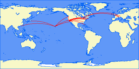
Hawaiian International Flight Reports for May 1999
Flight Reports are placed here from our famous world class pilots.
They are reported in the order in which I recieve them ie: The first one who files gets the first listing.
Map courtesy of Patrick Richardson
Click on Pilot's name (if in link format) to see their report.
Flight report for May 1999
HI 97 Kahului Kona Dash-800 Q400 25 min 96 NM Powerful and easy to handle plane. Beach One departure from rwy 20, V2
airway to UPP VOR, ILS approach to rwy 17 at Kona.
HI 96 Kona Kahului Dash-800 Q400 25 min 93 NM. Continuing flight-test of this excellent airplane.
HI 183 Kahului Kamuela (Panoramic flight) Dash-800 Q400 31 min 114 NM. Take off from rwy 20, climb to 5500ft to Beach
intersection (Beach one departure), descent to 2500ft and fly around Kahoolawe, joined airway V16 at Lavas intersection, climb to
9000ft, at UPP VOR descent to 5000 and followed the coast on the left, VOR approach to rwy 22 at Kamuela. Dash-800 Q400 is
approved for flying in HI standards.
HI 37 Honolulu Lanai Kahului Challenger 604 37 min 123 NM. Nice jumps between the islands with this powerful plane. I love
these flights. New tropical textures at Lanai, more realistic than X-Plane's standard.
HI 39 Kahului Molokai Honolulu Gulfstream V 33 min 132 NM. VFR flight to Molokai, with panoramic flight over Kalaupapa
and landing on runway 23, then IFR via V8 to Alana intersection, and DME Arc approach to runway 08L, where Stephan said the
smaller jets take-off and land. Nice flight with changing weather.
HI 80 Honolulu Lihue B 373, 20 min, 99 NM. It's interesting to fly again the "whale" after these high-performance jets.
Uneventful transfer to Lihue for panoramic flights.
HI 189 Lihue overflight Princeville Na Pali coast Waimea canyon Lihue. P-180 Avanti. 25 min, 89 NM. Sight-seeing and test
flight of Robert Pearsons' new P-180, a very peculiar canard fast turboprop. To test the slow speed handling better, I also landed at
Port Allen. The test ended with both pilot's and passengers satisfaction.
HI 658 London Paris Milan Airbus A340 1 hour 49 min. 673 NM. Nice IFR flight with complex SIDs and STARs. New
experimental scenery at Malpensa. Fine custom sounds for the A 340.
HI 81 Lihue Honolulu Airbus A320 20 min 94 NM. Test flight of the A320 with the new instrument panel. This is always a nice
flight.
HI 54 Honolulu Molokai Regional Jet, 15 min, 53 NM. Rough landing (three bumps!).
HI 55 Molokai Honolulu Regional Jet, 19 min, 77 NM. Hapai One departure, V8 airway, ILS approach an landing on runway 26L.
This time I trimmed well this nervous plane during cruise, with help from the autopilot, and performed a fine approach and smooth
landing.
HI 655 Barcelona Nice Milan Bombardier BRJ-X-90 1 hour 32 min, 453 NM. Bombardier asked me to flight test this new 88-pax
jetliner during a scheduled flight. It is a very interesting plane. Smooth flight from Barcelona to Nice, with IFR STAR and SID's,
then landing at Malpensa I found an unexpected storm with wind-shear at night. I performed a missed-approach and headed to
Lugano LSZA in Switzerland, where after a great scare I was able to do a perfect landing. X-Plane is VERY realistic in these
situations! The passengers where offered fine Swiss chocolate to forget the rough ride and the diversion.
Flight flown: 12
Segments flown: 17
Total time: 7 hous 31 minutes.
No problems, great fun as always.
HI01 PHNL-PHTO, 737, FL200, M.65, direct HTO, fuel used: 4621 lbs, time: 49m, bit of a shifting tail wind on landing.
HI93 1st leg: PHTO-PHGO, 757, 10,000ft, 250kts, fuel: 20372lbs (for full flight), 33m, gusty xwinds on landing
2nd leg: PHGO-PHLI, FL200, time 40m, M.67
HI87 PHLI-PHNL, 737, 10,000ft, M.45, fuel:2747lbs, time 28m, tough approach to HNL through a TS, let otto fly approach until 3 miles out.
HI10 PHNL-PHKO, 737, FL200, fuel:3344lbs, time: 37m, M.63
HI11 PHKO-PHNL, 737, FL200, fuel: 4032lbs, time 44m, M.64
, # of Hours:3.9, Problems:,
Reza or Patrick,
Depart: --> Los Angeles Intl. - Rwy 25R 0 NM 08:00
WX: 3900 Broken VIS 13 Wind calm
Arrive: --> San Francisco Intl. - Rwy 28R 300 NM 08:54
WX: 4000 Broken VIS 7 Wind calm
================================================================================
Aircraft: Boeing 737
Cruise: 440 knots, maximum range 3210 NM
Climb: 300 knots at 2500 ft/min (10 min, 50 NM)
Descend: 300 knots at 3000 ft/min (8 min, 40 NM)
================================================================================
1 Depart: Los Angeles Intl. - Rwy 25R 0 NM 08:00
--> Climb to 25000 feet.
2 Waypoint: Fillmore [FIM] VOR : 112.50 315° 35 NM 08:08
3 Waypoint: Fellows [FLW] VOR : 117.50 313° 66 NM 08:18
4 Waypoint: Priest [ROM] VOR : 110.00 328° 74 NM 08:28
5 Waypoint: Salinas [SNS] VOR : 117.30 305° 55 NM 08:36
6 Waypoint: San Jose [SJC] VOR : 114.10 339° 46 NM 08:44
------------------------------------------------------------------
7 Arrive: San Francisco Intl. - Rwy 28R 306° 24 NM 08:54
Runway heading 282°, altitude 11 ft ILS : 111.70
================================================================================
Total: 300 NM 00:54
________________________________________________________________________________
Flight HI481
Depart: --> San Francisco Intl. - Rwy 28R 0 NM 08:00
WX: 800 Broken VIS 10 WIND SHEAR ALERT Wind 250 at 13
Arrive: --> O'hare Intl - Rwy 27R 1620 NM 11:39
WX: Sky clear VIS 10 Wind light + variable
================================================================================
Cruise: 470 knots, maximum range 7300 NM
Climb: 350 knots at 1500 ft/min (20 min, 117 NM)
Descend: 300 knots at 1750 ft/min (17 min, 85 NM)
================================================================================
1 Depart: San Francisco Intl. - Rwy 28R 0 NM 08:00
--> Climb to 30000 feet.
2 Waypoint: Linden [LIN] VOR : 114.80 66° 70 NM 08:12
3 Waypoint: Mina [MVA] VOR : 115.10 77° 143 NM 08:32
4 Waypoint: Ely [ELY] VOR : 110.60 73° 155 NM 08:52
5 Waypoint: Fairfield [FFU] VOR : 116.60 65° 146 NM 09:11
6 Waypoint: Vernal [VEL] VOR : 108.20 86° 112 NM 09:25
7 Waypoint: Hayden [CHE] VOR : 115.60 84° 100 NM 09:38
8 Waypoint: Cheyenne [CYS] VOR : 113.10 69° 122 NM 09:54
9 Waypoint: Sidney [SNY] VOR : 115.90 94° 81 NM 10:04
10 Waypoint: Searle [SAE] VOR : 110.20 88° 55 NM 10:11
11 Waypoint: North Platte [LBF] VOR : 117.40 95° 47 NM 10:17
12 Waypoint: Wolbach [OBH] VOR : 114.80 79° 110 NM 10:31
13 Waypoint: Columbus [OLU] VOR : 111.80 84° 46 NM 10:37
14 Waypoint: Tekamah [TQE] VOR : 108.40 70° 55 NM 10:44
15 Waypoint: Des Moines [DSM] VOR : 117.50 99° 115 NM 10:59
16 Waypoint: Iowa City [IOW] VOR : 116.20 86° 92 NM 11:11
17 Waypoint: Davenport [CVA] VOR : 113.80 77° 52 NM 11:18
18 Waypoint: Polo [PLL] VOR : 111.20 70° 46 NM 11:24
------------------------------------------------------------------------
19 Arrive: O'hare Intl - Rwy 04R 89° 73 NM 11:39
Runway heading 41°, altitude 668 ft ILS : 110.10
================================================================================
Total: 1620 NM 03:39:00
________________________________________________________________________________
Flight HI503
Depart: --> Chicago O Hare International KORD 0 NM 10:00
WX: 4800 Scattered VIS 8 Wind light + variable
Arrive: --> Detroit City KDET 221 NM 10:36
WX: 3400 Broken VIS 10 Wind 160 at 6
================================================================================
Aircraft: Boeing 737-300
Cruise: 440 knots, maximum range 3470 NM
Climb: 300 knots at 2500 ft/min (9 min, 45 NM)
Descend: 300 knots at 3000 ft/min (7 min, 35 NM)
================================================================================
1 Depart: Chicago O Hare International KORD 0 NM 10:00
--> Climb to 22000 feet.
2 Waypoint: Keeler VOR [ELX] VOR : 116.60 82° 81 NM 10:16
3 Waypoint: Kalamazoo [AZO] VOR : 109.00 77° 26 NM 10:20
4 Waypoint: Jackson [JXN] VOR : 109.60 88° 49 NM 10:27
5 Waypoint: Salem VOR [SVM] VOR : 114.30 77° 39 NM 10:33
--------------------------------------------------------------------------------
6 Arrive: Detroit City KDET 90° 26 NM 10:45
Runway heading 72°, altitude 626 ft ILS : n.a.
================================================================================
Total: 221 NM 00:45
________________________________________________________________________________
Flight HI502
Depart: --> Detroit City KDET 0 NM 18:00
WX: 1700 Overcast VIS 4 Wind 240 at 12 RAIN
Arrive: --> Chicago O Hare International KORD 219 NM 18:35
WX: 2700 Overcast VIS 10 Wind 280 at 10
================================================================================
Aircraft: Boeing 737-300
Cruise: 440 knots, maximum range 3470 NM
Climb: 300 knots at 2500 ft/min (9 min, 45 NM)
Descend: 300 knots at 3000 ft/min (7 min, 35 NM)
================================================================================
1 Depart: Detroit City KDET 0 NM 18:00
--> Climb to 22000 feet.
2 Waypoint: Salem VOR [SVM] VOR : 114.30 271° 26 NM 18:05
3 Waypoint: Jackson [JXN] VOR : 109.60 257° 39 NM 18:11
4 Waypoint: Kalamazoo [AZO] VOR : 109.00 269° 49 NM 18:18
5 Waypoint: Keeler VOR [ELX] VOR : 116.60 258° 26 NM 18:22
--------------------------------------------------------------------------------
6 Arrive: Chicago O Hare International KORD 263° 79 NM 18:35
Runway heading 45°, altitude 668 ft
================================================================================
Total: 219 NM 00:35
________________________________________________________________________________
Flight HI507
--------------------------------------------------------------------------------
Depart: --> O'hare Intl - Rwy 27R 0 NM 18:00
WX: 2700 Overcast VIS 10 Wind 280 at 10
Arrive: --> Miami Intl. - Rwy 9L 1056 NM 20:28
WX: 3300 Broken VIS 10 Wind 160 at 9
================================================================================
Aircraft: Airbus A340
Cruise: 470 knots, maximum range 7300 NM
Climb: 350 knots at 1500 ft/min (26 min, 152 NM)
Descend: 300 knots at 1750 ft/min (22 min, 110 NM)
================================================================================
1 Depart: O'hare Intl - Rwy 27R 0 NM 18:00
--> Climb to 39000 feet.
2 Waypoint: Chicago Heights [CGT] VOR : 114.20 153° 32 NM 18:05
3 Waypoint: Boiler [BVT] VOR : 115.10 158° 62 NM 18:16
4 Waypoint: Indianapolis [VHP] VOR : 116.30 144° 55 NM 18:25
5 Waypoint: Nabb [ABB] VOR : 112.40 155° 81 NM 18:35
6 Waypoint: Livingston [LVT] VOR : 108.40 169° 122 NM 18:51
7 Waypoint: Hinch Mountain [HCH] VOR : 117.60 169° 49 NM 18:57
8 Waypoint: Peachtree [PDK] VOR : 116.60 163° 119 NM 19:12
9 Waypoint: Macon [MCN] VOR : 114.20 155° 78 NM 19:22
10 Waypoint: Vienna [VNA] VOR : 116.50 165° 30 NM 19:26
11 Waypoint: Taylor [TAY] VOR : 112.90 154° 113 NM 19:40
12 Waypoint: Gainesville [GNV] VOR : 116.20 170° 57 NM 19:47
13 Waypoint: Ocala Regional/Ji [OCF] VOR : 113.70 163° 25 NM 19:50
14 Waypoint: La Belle [LBV] VOR : 110.40 162° 148 NM 20:11
15 Waypoint: Miami [MIA] VOR : 115.90 136° 72 NM 20:25
--------------------------------------------------------------------------------
16 Arrive: Miami Intl. - Rwy 9L 139° 13 NM 20:28
Runway heading 91°, altitude 11 ft ILS : 110.90
================================================================================
Total: 1056 NM 02:28
________________________________________________________________________________
Fligh HI404
--------------------------------------------------------------------------------
Depart: --> Miami International KMIA 0 NM 19:00
WX: Sky clear VIS 10 Wind 180 at 9 GUST 15
Arrive: --> West Palm Beach Palm Beach In KPBI 55 NM 19:09
WX: Overcast VIS 6 in HAZE Wind 250 at 7
================================================================================
Aircraft: Boeing 737-300
Cruise: 440 knots, maximum range 3470 NM
Climb: 300 knots at 2500 ft/min (2 min, 10 NM)
Descend: 300 knots at 3000 ft/min (2 min, 10 NM)
================================================================================
1 Depart: Miami International KMIA 0 NM 19:00
--> Climb to 5000 feet.
2 Waypoint: Pompano Beach [PMP] VOR : 108.80 20° 29 NM 19:05
--------------------------------------------------------------------------------
3 Arrive: West Palm Beach Palm Beach In KPBI 1° 26 NM 19:09
Runway heading 98°, altitude 19 ft
================================================================================
Total: 55 NM 00:09
________________________________________________________________________________
Flight HI405
--------------------------------------------------------------------------------
Depart: --> West Palm Beach Palm Beach In KPBI 0 NM 20:00
WX: Overcast VIS 6 in HAZE Wind 250 at 7
Arrive: --> Miami International KMIA 55 NM 20:09
WX: Sky clear VIS 10 Wind 180 at 9 GUST 15
================================================================================
Aircraft: Boeing 737-300
Cruise: 440 knots, maximum range 3470 NM
Climb: 300 knots at 2500 ft/min (2 min, 10 NM)
Descend: 300 knots at 3000 ft/min (2 min, 10 NM)
================================================================================
1 Depart: West Palm Beach Palm Beach In KPBI 0 NM 20:00
--> Climb to 5000 feet.
2 Waypoint: Pompano Beach [PMP] VOR : 108.80 181° 26 NM 20:04
-------------------------------------------------------------------------------
3 Arrive: Miami International KMIA 200° 29 NM 20:09
Runway heading 124°, altitude 11 ft
================================================================================
Total: 55 NM 00:09
________________________________________________________________________________
Flight HI506
--------------------------------------------------------------------------------
Depart: --> Miami Intl. - Rwy 9L 0 NM 18:00
WX: 300 Scattered VIS 10 Wind 330 at 5
Arrive: --> O'hare Intl - Rwy 27R 1056 NM 20:26
WX: 15000 Overcast VIS 10 Wind 190 at 5
================================================================================
Aircraft: Airbus A340
Cruise: 470 knots, maximum range 7300 NM
Climb: 350 knots at 1500 ft/min (26 min, 152 NM)
Descend: 300 knots at 1750 ft/min (22 min, 110 NM)
================================================================================
1 Depart: Miami Intl. - Rwy 9L 0 NM 18:00
--> Climb to 39000 feet.
2 Waypoint: Miami [MIA] VOR : 115.90 319° 13 NM 18:02
3 Waypoint: La Belle [LBV] VOR : 110.40 316° 72 NM 18:14
4 Waypoint: Ocala Regional/Ji [OCF] VOR : 113.70 343° 148 NM 18:35
5 Waypoint: Gainesville [GNV] VOR : 116.20 343° 25 NM 18:38
6 Waypoint: Taylor [TAY] VOR : 112.90 350° 57 NM 18:45
7 Waypoint: Vienna [VNA] VOR : 116.50 335° 113 NM 18:59
8 Waypoint: Macon [MCN] VOR : 114.20 345° 30 NM 19:03
9 Waypoint: Peachtree [PDK] VOR : 116.60 335° 78 NM 19:13
10 Waypoint: Hinch Mountain [HCH] VOR : 117.60 344° 119 NM 19:28
11 Waypoint: Livingston [LVT] VOR : 108.40 349° 49 NM 19:34
12 Waypoint: Nabb [ABB] VOR : 112.40 350° 122 NM 19:50
13 Waypoint: Indianapolis [VHP] VOR : 116.30 335° 81 NM 20:00
14 Waypoint: Boiler [BVT] VOR : 115.10 324° 55 NM 20:08
15 Waypoint: Chicago Heights [CGT] VOR : 114.20 339° 62 NM 20:20
--------------------------------------------------------------------------------
16 Arrive: O'hare Intl - Rwy 27R 333° 32 NM 20:26
Runway heading 271°, altitude 668 ft ILS : 111.10
================================================================================
Total: 1056 NM 02:26
GRAND TOTAL FOR May 1999 4582 NM , 11 hours 5 minutes, Problems:, Submit
---------------------------------------------------------------------------
(Flight Segment) 8
Flights for May:
HI92: Weather at Lihue was clear, 10 mi vis. Smooth flight, overcast over
Honolulu. 38:11 total time
HI303: 20K scattered at DC, uneventful flight NE to JFK. Landed visual on
4L, 31 minutes total
HI500: BOS weather 17K scattered, 6mph wind. Weather from Detroit to ORD
varied. ORD had 800Ft overcast, cleared ILS runway 9L. Phew, got good
practice flying the needle!!! 2hr flight time
3Hr 9min total time, 3 segments, no problems
I will be taking a leave of absence in June. I'm on vacation for two weeks. Heading for the beach North Carolina, not Hawaii :)
HI82 HNL-LIH B737 0:24
HI83 LIH-HNL B737 0:30
HI50 HNL-MKK ATR 0:23
HI51 MKK-HNL ATR 0:27
HI30 HNL-OGG B767 0:27
HI31 OGG-HNL B767 0:28, #of Hours:2:39, Problems:, Submit
---------------------------------------------------------------------------
(Flight Segment) Flight Segments:6
04/01/99 Thursday PHNL Honolulu, HI. PHKO Kona, HI. 737 V 0.30 14 04/01/99 Thursday PHKO Kona, HI. PHNL Honolulu, HI. 737 V 0.30 15 04/04/99 Sunday PHNL Honolulu, HI. PHOG Kahului, HI. 737 I 0.25 34 04/04/99 Sunday PHNL Honolulu, HI. PHOG Kahului, HI. 737 I 0.35 36 04/05/99 Monday PHMK Kanaukaki, HI PHNL Honolulu, HI. Canadair Reg J V 0.20 53 04/05/99 Monday PHNL Honolulu, HI. PHMKK Kanaukaki, HI Canadair Reg J V 0.20 54 04/08/99 Thursday PHNL Honolulu, HI. PHNY Lanai City, HI. Canadair Reg J V 0.20 74 04/08/99 Thursday PHNY Lanai City, HI. PHNL Honolulu, HI. Canadair Reg J V 0.20 75 04/10/99 Saturday PHNL Honolulu, HI. PHLI Lihue, HI. 737 V 0.25 80 04/10/99 Saturday PHLI Lihue, HI. PHNL Honolulu, HI. 737 V 0.25 81 04/11/99 Sunday PHNL Honolulu, HI. PHLI Lihue, HI. 737 V 0.25 82 04/11/99 Sunday PHLI Lihue, HI. PHNL Honolulu, HI. 737 V 0.25 83 04/15/99 Thursday PHKO Kona, HI. PHLI Lihue, HI. 757 V 0.45 98 04/15/99 Thursday PHLI Lihue, HI. PHNL Honolulu, HI. 757 V 0.50 99 04/18/99 Sunday PHNL Honolulu, HI. HI01 Princeville, HI Saab 340 V 0.35 101 04/18/99 Sunday HI01 Princeville, HI PHNL Honolulu, HI. Saab 340 V 0.35 102 04/19/99 Monday PHLI Lihue, HI. PHLI Lihue, HI. V 1.00 189 04/20/99 Tuesday KLAX Los Angeles, CA. PHNL Honolulu, HI. CONCORDE V 3.00 202 04/25/99 Sunday KMIA Miami, FL. GCM Grand Cayman 737 V 1.50 04/26/99 Monday GCM Grand Cayman KMIA Miami, FL. 737 V 1.50 04/27/99 Tuesday PHKO Kona, HI. PHTO Hilo, HI. 737 V 0.20 04/27/99 Tuesday PHTO Hilo, HI. PHKO Kona, HI. 737 V 0.20 04/28/99 Wednesday KMIA Miami, FL. MYNN Nassau, Bahamas A340 I 0.35 622 Severe Windshear 04/28/99 Wednesday MYNN Nassau, Bahamas KMIA Miami, FL. A340 I 0.35 623 Total Time 12.75 Flight Numbers 24.00
Stephan Buchmann, Reporting for what month:May
99, Today's Date:31.Mai 99, Flights:HI 34 23min used my new Approach
Maps (Did you hear about the smoke stack app.?)
HI 35 25min
HI 682 62min
HI 683 74min, #of Hours:03h 04min, Problems:HI 682 : EHAMs ATIS and maps appear very late in Xplane - about 40NM before Amsterdam. I think I did the softest touchdown ever (due to the new installed 4.70?). The new (at least to me) broken clouds look funny from above though, hundreds of squares of broken cloud layers! Is there a problem with the cloud bitmap?
, Submit
---------------------------------------------------------------------------
(Flight Segment) Flight Segments:4
Date: 5-31-99
Flights for this month:
HI36 38 min
HI52 15 min
HI53 13 min
HI72 26 min 15 min
HI73 13 min 25 min
HI84 26 min
HI85 22 min
HI201 5 hrs 27 min
HI200c 2 hrs 38 min
HI201c 2 hrs 36 min
Total Time: 13 hrs 49 min
Flights Flown: 10
Problems Encountered:
HI201: Lost pitot and static instruments 900 miles out from PHNL, I was
forced to use my OAT as an altimeter (its not easy) and keep power at cruise
and continue on. I landed safely at Honolulu after flying an approach at
about 20 kts above the normal approach speed to ensure that I wouldn't stall.
I used my radio altimeter as soon as I got low enough. And got my airspeed
info from the HNL VOR as soon as I was in range.
Hope You had a great trip Reza !!!!!!!!!!!!!!!!
Total IFR Flight Time: 20 hrs. : 19 min. Total VFR Flight Time: 1 hrs. : 39 min. Total Flight Time: 21 hrs. : 58 min. HIA Flight Legs: 23 IFR/ Duration: Date: Day: From: City: To: City: Aircraft: VFR (Hrs.) HIA Flight: 5/8/99 Saturday PHNL Honolulu, HI. PHMK Kaunakakai/Hoolehua, HI. Gulfstream-V V 0.37 HI38 5/8/99 Saturday PHMK Kaunakakai/Hoolehua, HI. PHOG Kahului, HI. Gulfstream-V I 0.37 " 5/9/99 Sunday PHNL Honolulu, HI. PHLI Lihue, HI. Airbus A-330/200 I 0.45 HI86 5/9/99 Sunday PHLI Lihue, HI. PHKO Kona, HI. Boeing 757 I 0.83 HI94 5/9/99 Sunday PHKO Kona, HI. PHLI Lihue, HI. Boeing 757 I 0.73 HI95 5/12/99 Wednesday PHKO Kona, HI. PHMU Waimea-Kohala, HI. Canadair V 0.23 HI100 5/12/99 Wednesday PHMU Waimea-Kohala, HI. PHTO Hilo, HI. Canadair I 0.43 " 5/14/99 Friday PHTO Hilo, HI. PHMU Waimea-Kohala, HI. Canadiar V 0.27 HI101 5/14/99 Friday PHMU Waimea-Kohala, HI. PHKO Kona, HI. Canadiar I 0.32 " 5/14/99 Friday KJFK New York, NY. (JFK) KPIT Pittsburgh, PA. Boeing 737 I 1.02 HI304 5/14/99 Friday KPIT Pittsburgh, PA. KJFK New York, NY. (JFK) Boeing 737 I 0.97 HI305 5/14/99 Friday KSFO San Fransisco, CA. KFAT Fresno, CA. Boeing 737 I 0.65 HI450 5/14/99 Friday KFAT Fresno, CA. KSFO San Fransisco, CA. Boeing 737 I 0.63 HI451 5/14/99 Friday KSFO San Fransisco, CA. KLAX Los Angeles, CA. Airbus A-320 I 0.88 HI452 5/18/99 Tuesday KSFO San Fransisco, CA. KSAN San Diego, CA. MD-11 I 1.18 HI454 5/18/99 Tuesday KSAN San Diego, CA. KSFO San Fransisco, CA. MD-11 I 1.27 HI455 5/22/99 Saturday PHLI Lihue, HI. PHKO Kona, HI. Boeing 747 I 0.85 HI104c 5/22/99 Saturday PHKO Kona, HI. PHOG Kahului, HI. Boeing 757 I 0.43 HI107c 5/22/99 Saturday PHOG Kahului, HI. PHKO Kona, HI. Boeing 757 I 0.45 HI108c 5/22/99 Saturday KDTW Detroit, MI. KMSP Minneapolis/St. Paul, MN. Airbus A-340 I 1.28 HI482 5/22/99 Saturday KMSP Minneapolis/St. Paul, MN. KSFO San Fransisco, CA. Airbus A-340 I 3.67 " 5/22/99 Saturday PHNL Honolulu, HI. PHMK Kaunakakai/Hoolehua, HI. Saab-2000 V 0.35 HI40 5/22/99 Saturday PHMK Kaunakakai/Hoolehua, HI. PHHN Hana/Maui, HI. Saab-2000 V 0.43 " 5/24/99 Monday KLGA New York, NY. (Laguardia) KPWM Portland, ME. Boeing 737 I 0.82 HI320 5/24/99 Monday KPWM Portland, ME. KLGA New York, NY. (Laguardia) Boeing 737 I 0.93 HI321 5/26/99 Wednesday KJFK New York, NY. (JFK) KHFD Hartfort, CT. EMB-145 I 0.45 HI322 5/26/99 Wednesday KHFD Hartfort, CT. KJFK New York, NY. (JFK) EMB-145 I 0.47 HI323 5/31/99 Monday KDTW Detroit, MI. KLGA New York, NY. (Laguardia) Boeing 767 I 1.25 HI325
John Landry
jon hay, Reporting for what month:May 1999, Today's
Date:June 3, 1999, Flights: time TTl TTL
Month Flght# Type Dep Dest leave Arrive enrte Seg Mth
01-May-99 HI306 EMB120 KLGA KPHL 15:44 16:17 00:33
01-May-99 HI307 EMB120 KPHL KLGA 20:27 20:58 00:31 01:04
01-May-99 HI402 B737-3 KMIA KMCO 13:05 13:37 00:32
01-May-99 HI403 B737-3 KMCO KMIA 15:37 16:13 00:36 01:08
01-May-99 HI406 B737-2 KMIA KTPA 00:06 00:45 00:39
01-May-99 HI407 B737-2 KTPA KMIA 02:12 02:49 00:37 01:16
01-May-99 HI408 ATR42 KMIA KEYW 12:58 13:32 00:34
01-May-99 HI409 ATR42 KEYW KMIA 14:08 14:39 00:31 01:05 04:33, #of Hours:4:33, Problems:, Submit
---------------------------------------------------------------------------
(Flight Segment) Flight Segments:8
Jim Murray, Reporting for what month:May 99,
Today's Date:6/4/99, Flights:
HI316 - JFK to BTV, 1:20
HI317 - BTV to JFK, 1:25
HI320 - JFK to PWM, 1:32
HI501(?) ORD to BOS, 2:35, #of Hours:6:52, Problems:None, Submit
---------------------------------------------------------------------------
(Flight Segment) Flight Segments:4
Barrie Myers
FLIGHT HI101C KONA (PHKO) TO HILO (PHTO)
Take off time was 2200 and at the ramp at Hilo at 2226
Total time was 26 minutes
Aircraft was a 747, I used 12172 lbs of fuel, distance travelled was 89 miles
(GPS 56)
Normal flight, SAS trouble on the was but little effect. Very windy.
FLIGHT HI102C HILO (PHTO) TO KONA (PHKO)
Take off time was 2300 and at the ramp at Kona at 2321
Total time was 21 minutes
Aircraft 747, fuel used was 13372 lbs and distance travelled was 82 miles (GPS
56 miles)
Nice flight, no problems.
FLIGHT HI300 NEW YORK (KJFK) TO BOSTON LOGAN (KBOS)
Take off at 2200 and at the ramp at Boston at 2243
Total time was 43 minutes
Aircraft used was a 737, fuel used 4290 lbs and distance travelled was 160 miles
No problems
FLIGHT HI311 BOSTON LOGAN (KBOS) TO NEW YORK (KJFK)
Take off at 0000 and at the ramp at New York at 0037
Total time 37 minutes
Aircraft was a 737, fuel used 3501 lbs and distance travelled was 160 miles
No problems, quicker return time and less fuel I put down to a straight in
approach at JFK on runway 22L
FLIGHT HI326 NEW YORK (KJFK) TO MARTHA‚S VINEYARD (KMVY) ALSO LANDING AT
BLOCK ISLAND (KBID)
Take off 0830 and at the ramp at Block Island at 0905
Total time 35 minutes
Aircraft EMB, fuel used 916 lbs and distance was 105 miles.
Lost auto pilot, to be repaired at Block Island
CONTINUATION FLIGHT HI326 BLOCK ISLAND (KBID) TO MARTHA‚S VINEYARD (KMVY)
Take off from Block Island at 0945 and at the ramp at Martha‚s Vineyard at 1010
Total time for second leg 25 minutes
Fuel used 580 lbs and distance was 45 miles
Flap malfunction on second leg.
FLIGHT HI327 MARTHA‚S VINEYARD (KMVY) TO NEW YORK (KJFK) ALSO LANDING AT BLOCK
ISLAND (KBID)
Take off 1700 and at the gate at Block Island at 1727
Total time 27 minutes
Aircraft was an EMB, fuel used 911 lbs, distance 45 miles
High fuel usage compared to outward journey no doubt due to missed approach. I
came in too fast and had to abort landing and go around again. Second time was
successful with no problems and a slower approach speed.
CONTINUATION FLIGHT HI327 BLOCK ISLAND (KBID) TO NEW YORK (KJFK)
Take off from Block Island 1800 and at the gate at New York at 1829
Total time 29 minutes
Aircraft EMB, fuel used 889 lbs, distance 105 miles
Flew higher, and faster, to make up time for passengers because of extra time
on first leg, although fuel consumption was less than on outward journey. No problems.
FLIGHT HI90 HONOLULU (PHNL) TO KONA (PHKO), ALSO LANDING AT KAHULUI (PHOG)
Take off 1000 and at the ramp at Kahului at 1025
Total time 25 minutes
Aircraft 737, fuel used 2324 lbs, distance 90 miles.
No problems.
CONTINUATION FLIGHT HI90 KAHULUI (PHOG) TO KONA (PHKO)
Take off from Kahului at 1100 and at the ramp at Kona at 1122
Total time 22 minutes
Aircraft 737, fuel used 2326 lbs, distance 75 miles
Nice journey, no problems with aircraft.
FLIGHT HI91 KONA (PHKO) TO HONOLULU (PHNL), ALSO LANDING AT KAHULUI (PHOG)
Take off time1400 and at the ramp at Kahului at 1420
Total time 20 minutes
Aircraft 737, fuel used 2203 lbs, distance 75 miles
No problems
CONTINUATION FLIGHT HI91 KAHULUI (PHOG) TO HONOLULU (PHNL)
Take off from Kahului at 1500 and at the ramp at Homolulu at 1534
Total time 34 minutes
Aircraft 737, fuel used 3982 lbs, distance 90 miles
A problem here on landing, which accounts for excess time and fuel used. Just
before locking on to the ILS at Honolulu the HSI malfunctioned. I followed ATC
instructions manually but eventually was forced to abort the landing and ask
for the ILS at runway 04. I discovered a few minutes later that the aircraft
would follow the bug setting on the HSI, but that the compass did not turn.
This made things easier and I landed on 04 some nine minutes late. Hopefully
the problem can be sorted at Honoluu.
FLIGHT HI03 HONOLULU (PHNL) TO HILO (PHTO)
Take off time 1200 and at the gate at Hilo at 1251
Total time 51 minutes
Aircraft 737, fuel used 4277 lbs, distance 189 miles
No problems until approaching Hilo when we encountered a tropical storm.
Considered diverting, but it eased slightly so made an ILS landing on runway
26L. Although we shook about a bit I do not consider that there was any danger
to the aircraft or occupants, and we landed safely, although a little late.
FLIGHT HI180 KONA TO KONA (PHKO)
visiting Volcano National Park and Kilauea Crater
Take off time 0900 and at the gate at 0927
Total time 30 minutes
Aircraft ATR42, fuel used 225 lbs
No problems
FLIGHT HI 181 KONA TO KONA (PHKO)
visiting Mauna Key and Observatory
Take off 0900 and back on the ramp at 0929
Total time 29 minutes
Aircraft ATR42, fuel used 176 lbs
No problems.
FLIGHT HI08 HILO (PHTO) TO HONOLULU (PHNL)
Take off 2100 and at the gate at 2135
Total time 35 minutes
Aircraft 737, fuel used 3628 lbs, distance 189 miles
Nice flight, but had to land manually as instructions were incorrect. This
necessitated a steeper than usual descent. No complaints.
FLIGHT HI09 HONOLULU (PHNL) TO HILO (PHTO)
Take off 2200 and on the ramp at 2246
Total time 46 minutes
Aircraft 737, fuel used 4084 lbs, distance 189 miles
No problems on this flight. Landed in slight rain after uneventful trip
Barrie Myers
TOTAL FLYING HOURS FOR MAY
8 hours 34 minutes
Patrick Richardson
HI200 4hrs10min
HI333 SFO-DFW 3hrs20min DFW-JFK 4hrs15min
HI482 dtw-msp 2hrs50min msp-sfo 4hrs 25min
HI633 Kingston-MIA 3hrs10min
6 segments flown
20:55 hrs
This page is part of Hawaiian International VA.