Hawaiian International Flight Reports for April 2000
8.30.99
Hawaiian International Flight Reports for April 2000
Flight Reports are placed here from our famous world class pilots.
They are reported in the order in which I recieve them ie: The first one who files gets the first listing.
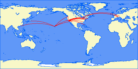
Map courtesy of Patrick Richardson
Click on Pilot's name (if in link format) to see their report.
|
|
|
Reza Gorji
April 2000 Flights HI Flight Origin Origin Arrive Arrive Aircraft Mode Time in min Observations HI86 PHLI Lihue, HI. PHNL Honolulu, HI. A320 I 25.00 Very Windy in Lihue HI87 PHNL Honolulu, HI. PHLI Lihue, HI. A320 I 20.00 HI88 PHLI Lihue, HI. PHNL Honolulu, HI. A320 I 25.00 HI89 PHNL Honolulu, HI. PHLI Lihue, HI. A320 I 22.00 HI92 PHLI Lihue, HI. PHTO Hilo, HI. A320 V 58.00 VIA OGG HI93 PHTO Hilo, HI. PHLI Lihue, HI. A320 V 57.00 VIA OGG HI99 PHKO Kona, HI. PHTO Hilo, HI. A320 V 20.00 HI106 PHTO Hilo, HI. PHNY Lanai City, HI. DASH 8 V 45.00 Via Kona, low visibiltiy in Hilo HI107 PHNY Lanai City, HI. PHTO Hilo, HI. DASH 8 45.00 Via Kona HI211 PHNL Honolulu, HI. Johnston Atoll A320 V 130.00 HI212 Johnston Atoll PHNL Honolulu, HI. A320 V 140.00 HI624 MIA Miami GCM Grand Cayman A320 V 80.00 HI625 GCM Grand Cayman MIA Miami A320 V 90.00 Total Flight Time is: 757.00 12 hours and 37 minutes Number of Flights is: 13 Airline at full capacity. Really enjoyed the flights.
No major problems.
Airline at full capacity. Really enjoyed the flights. No major
problems.
Does it ever stop raining in Hilo !!!!!!!!!!!
Bruce Buffa
Reza,
Here are the results of my flights for April 2000.
HI300 KJFK-KBOS 737 162 miles 52 minutes
HI301 KBOS-KJFK 737 162 miles 32 minutes
HI302 KJFK-KDCA 737 183 miles 76 minutes
HI303 KDCA-KJFK 737 183 miles 46 minutes
HI306 KJFK-KPHL EMB120 81 miles 57 minutes
HI307 KPHL-KJFK EMB120 82 miles 63 minutes
HI400 KMIA-KSWR EMB120 91 miles 40 minutes
HI401 KSWR-KMIA EMB120 91 miles 55 minutes
HI402 KMIA-KMCO A320 168 miles 49 minutes
HI403 KMCO-KMIA A320 169 miles 45 minutes
HI404 KMIA-KTPA 737 178 miles 34 minutes
HI405 KTPA-KMIA 737 178 miles 41 minutes
HI406 KMIA-KEYW ATR 109 miles 48 minutes
HI407 KEYW-KMIA ATR 109 miles 42 minutes
14 legs
Total time - 11 hours, 24 minutes
No incidents
Dean Georgaris
APRIL FLIGHTS:
HI #202 -- We left gate 41 at 8:09am
with 179993 lbs of stateside bound passengers, their bags, and a load of
Hawaiian Airlines Cargo. Manifest indicated 113462 lbs of fuel on board
when we left the gate. A ten minute taxi and final check put us at runway
04 at 8:12 am. Took off with 2/3 flaps due to departure procedures.
Climbed via Molokai 4 departure, then via Molokai VOR to V8 at 12,000 on our
way to a cruise at 35,000 feet and 496kts. PROBLEM ONE occurred about 2hrs
into flight, when we lost all radio related navs, etc... Maintained 056
degrees heading until reaching Los Angeles Approach, and requested precision
vectors from there. Luckily, the weather in Los Angeles was perfect.
PROBLEM TWO crept up with about 45 minutes left to fly. We got a bad right
gear indication, and on approach, discovered the right rear gear to be
in-operative. We tried banging it down, and hand cranking, but to no avail.
After some discussion, decided that the right front gear should hold
provided we came in low and slow and didn't brake too hard. So, we followed
vectors to Runway 25R, and it was a VFR landing due to total lack of nav
aids. Full flaps, nearly 70% power, high nose -- touched down softly and am
happy to report the right gear held. Very careful taxi put us at the gate
at 16:15 pst - for a flight time of 5hrs 12mins. Fuel burned: 83122
*
HI # 203 -- Flew the 747-400 -- take
off at 112357lbs fuel and a capacity cabin with 217258lbs of people and
bags. The plane flew like a slug. We took off on time at 20:07 PST and
climbed slowly to a final cruise at 34,000 ft. At 92% power cruise speed
was 497kts. Smooth flight until we approached the islands. PHNL reported
extremely gusty winds to 29, with a wind shear alert. After consulting with
HI headquarters, we decided to try an approach to see how bad it was on
final to runway 04R. With full flaps, the approach was roller-coaster
like, and I'm sure the passengers were a little nervous. Autopilot didn't
help at all so flew the approach manual. Was to ready to go around at any
moment. Managed somehow to put the plane down softly, dead-center, a little
further down the runway than normal, but still with plenty of room to stop
at near MLW. (Wish I hadn't waited too long to switch to replay mode --
I'd like to see that one again) At the gate at 22:25 local time. Burned
88,210lbs fuel with the protracted approach.
**ADVISE ALL TRAFFIC TO DIVERT UNTIL WEATHER IMPROVES**
*
HI Flight # 451 737-300 From LAX TO SFO. Took off on time with 21162lbs
payload and 9396 lbs fuel. We departed from runway 25, flew out over the
pacific and then turned right to a heading of 305 degrees and a cruise at
28,000 feet.
PROBLEM occurred about 20 minutes into flight. An electrical failure knocked
out all of the cockpit instruments. We were flying blind. With help from
the control tower (output data to the window) we were able to land safely at
SFO on runway 28R. Lucky for us the weather was good. At the Ramp 45
minutes after departure. Seems like I'm getting some bad luck this month.
Burned 9396-4447=4949 gallons of fuel.
*
Hi Flight # 450 737-300 From SFO to LAX. What started off as an
uneventful flight turned into a very scary experience. We departed on-time
from San Francisco, taking off on Runway 28, and flying out over the ocean
before turning towards Los Angeles. We stayed out to sea, avoiding Point
Magu naval air-station and were about to turn South East on the familiar
feeder route over Santa Monica before turning back to the west to land.
However, the 737 SUFFERED A MASSIVE HYDRAULLICS FAILURE. Back-up systems did
not work, which meant the only control we had over the plane's direction was
with thrust. (if i weren't flying for an airline - i turn the computer off
right there) Using Autopilot to control speed and our descent, I was able
to fly a wide inland loop, getting a feel for how to control the direction
of the airplane. Declaring an Emergency, we were cleared into LAX runway 25
R. The good news is, I am happy to say the plane landed safely. The bad
news is it was on runway 24L. When I realized I had a good shot and making
the landing as I was lined up, I switched the Navs over to 24L and took it
it. I let the autopilot control the glideslope, set the speed to 165, and
concentrated on the direction. I knew 24L was clear because I'd declared,
and trying to correct to 25R would have been risky -- frankly I wouldn't
have been able to do it. Nor could I have done it if the winds were anything
but calm. Very lucky with the real weather. I was unable to taxi to the
ramp, I had to be towed in. For the rest of the month i'm switching my
reliability factor to 0 on all flights - I can't take any more problems.
I'm going to the airport bar and having a nice stiff drink, then going to go
home and kiss my wife.
*
HI Flight #12. The SOUTH BEACH EXPRESS. PHNL-PHKO. Our 737-300 left on time.
Not too crowded because our connecting flight from the States was delayed
and those passengers will be on our next run. Weights were 20490 lbs.
payload and 7772 of fuel. Took off this gusty morning from runway 04, and
climbed steeply to 110 degrees per Palay departure. From there Via LANAI
VOR and V7 to Kona at 21,000 feet. Kona had a strong crosswind approach to
runway 17, with wind gusting to near 20kts out of the 050. Landing was a
little rough, I'm sure we woke up any of our geese that had dozed off. Must
have had a gust of tailwind just as we were flaring, because we had no
flare. No bounce though. At the gate 41 minutes after the hour.
HI Flight #13. THE CAPITAL RUN. PHKO-PHNL. The 737-300 departed gate 13a on
schedule. Departure was from Runway 17. Initiated right turn at 500 feet,
turned to 297 degrees, intercepted V20 which we followed up to our cruise of
20,000 feet. Easy approach to Runway 04. At the gate 41:10 seconds after
departure. Total for the manifest. TW = 20822 payload + 7558 fuel. At the
gate with 3925 Fuel, for a total burn of 3633 lbs.
HI Flight #14 The SOUTH BEACH EXPRESS. PHNL-PHKO. The Jumbo from the States
got in, so we were loaded. Calculations to allow a safe MLW meant we took a
full airplane of passengers and as many bags as possible to bring us to a
payload of 37621 lbs. 7967 Gallons of Fuel in our tanks. A long, awkward
taxi put us at the crown of Runway 04. Gusty winds and near MTOW meant a
one notch flaps departure with immediate climbing right turn towards OPHI
DEPARTURE. Held at 5000 feet until cleared to turn left and intercept V20
for a final cruise of 19,000 Feet. It was a bumpy ride all the way down the
islands. Traffic meant we had a somewhat tricky approach, with an nearly 90
degree right turn onto final at 9.2 DME. Crosswinds weren't too bad, now
that I am getting used to them, though one of these days I'm actually going
to use the autopilot to get me to decision height. Does Kona EVER use
runway 35 with their winds? Landed and a quick Taxi put us at the gate in
42 Mins, 21 seconds. Fuel used was 7967-4162 = 3805lbs.
Hi Flight #15 THE CAPITAL RUN. PHKO-PHNL. I'm happy to report this flight
was pleasant with little problems. We got cleared for our standard
departure and direct IFR route. Weather was windy, so we cruised @ 22K ft
to give the passengers a smoother ride. HNL has been using 04 lately and on
this flight it was no different. We were vectored into a right traffic
pattern and touched down for a flight time of 35 mins 46 seconds. Burned
4014 lbs of aviation grade fuel.
Hi Flight # 16 The LATE NITE SOUTH BEACH EXPRESS. PHNL-PHKO. With daylight
savings time here it's amazing how much light there is left now. Add to that
a full moon, and we had the recipe for a great flight. Unfortunately for
our passengers, the sky was overcast @ 10K feet. We took off heavy with
35605 lbs passengers and cargo / 7354 fuel. Noise restrictions meant a
longer climb out with a sharp turn north and the eventually east and down to
the MKK VOR. From there to LNY to VECKI and into runway 17 at Kona.
Typical gusty winds. Quick taxi put us at the gate in 41:28.
Hi Flight #17 THE LAST CHANCE. PHKO-PHNL. Not may takers today. A light
load with total of 16795 lbs payload including all the packages. Only took
7100 lbs fuel. No traffic, taxi right into take-off from 17. SID. Cruise
@18k. No views because ceiling was down to 2500 scattered. Must've got a
new controller because my turn onto final for 04r was 120 at dme 9.2. When
are they going to get rid of 04L anyway? In at the gate 40:14 Seconds.
3790 Lbs fuel burned - throttle never got past 85% above 10K.
HI Flight number 660 - Airbus A320. Scheduled to depart Milan Malpensa
at 9am for Athens. The manifest indicated 45121 lbs estimated payload and
18680 lbs fuel. Left the gate at 9:05 - 7 minute direct taxi put us at
runway 35 R at 9:12. Flew SID, climbing right turn to 5000 enroute to
Rimini. From Rimini we cruised at 33,000 feet down the "boot", giving our
passengers a stunning of the coast. Then, across the sea to Corfu (one of
the most beautiful islands in all of Greece) and then a gradual descent to
Algina ADB @ 4000. Descending left turn onto final of 333 degrees.
Visibility was poor from Corfu on in, so the passengesr didn't get to see
much. Approach was a little steep because I misread the chart and came in
1k too high onto the final. Down safely on 33R. At the gate 11:16 . Burned
15,900 lbs fuel -- leaving me with less in the tank than I felt safe with:
25 mins reserve.
Hi Flight number 661 - Airbus A320. Departed Athens on-time at 1900. 48198
was take-off payload weight. 20305 lbs of fuel this time. Departed runway
33, turned left at 600 ft per departure for Algina. From there to course 273
and direct to Perugia at 32K cruise. From Perugia over Florence to
transition at Voghera NDB. From there descending through 4000 feet over
Novara and onto final. Weather was thunderstoms, and the edge of a violent
cell came in, so I filed a missed approach and climbed out to 4K to RMG
lctr. Tower brought me back around. Better weather, but the glideslope into
35R was weird. Down safely and at the gate at 21:22 . Burned 16,100 lbs.
Hi Flight number 650 - Airbus A320. The Airbus is an amazingly versatile
plane to fly. Today's flight left on-time from Malpensa with 50762 lbs of
passengers and bags bound for either Munich or Vienna. Fuel for the first
leg to Munchen was 11912 lbs. Departure from 35 R and turned left before
gradually climbing to 17,000 feet for a truly spectacular ride over the alps
in misty conditions at twilight. Began the approach via the EURACH VOR and
then flew ANDEC 08 approach due to heavy traffic. I tried to follow all the
right and left turns and step downs of the Approach by outputting long. and
lat. to the cockpit. We landed on Runway 08R. The flight time to 57 minutes
14 seconds. We burned 5228 lbs fuel.
THE CONTINUATIOM of Flight 650. Departed Munich for Vienna at 20 minutes
after the hour. We departed runway 08R and flew the KIRDI 3E departure to
LINZ VOR and then from LINZ to STOCKERAU to STEINHOF at the top of the final
into Vienna Runway 11. Cruise was 15k feet at 492kts. Burned 5114 lbs of
fuel. Flight time was 54:12. In on-time. Nice flight - great scenery
packages.
HI FLIGHT #651 with Aloha service from Vienna to Munich continuing onto
Milan Malpensa. Our Airbus A320 shut its door at 19:02 with 44096 lbs in
the manifest and 11641 lbs of fuel for our first leg. A 8 minute taxi
brought us to the top of runway 32. We were flying the Linz 4D route, so we
departed and climbed at initial max rate of 3500 fpm and held runway
heading. At 12 miles to Wagram VOR we were cleared to turn left to 210 and
intercepted the Fishamend VOR radial 270. We followed the radial out for
approx. 10nm before turning right to 300 and intercepting 98 direct to LINZ.
From LINZ to MOOSBURG and then followed the MOOSBURG 08 arrival into Munich
08L. Our cruise was 16k ft at 492kts. Landed smooth and at the gate
on-time at 19:58. Burned 5300 lbs of fuel.
FAST TURNAROUND -- and we added a few more passengers. We deaprted the gate
at 20:11 with 48711 lbs in the manifest and 12724 lbs fuel. An 8 minute
taxi brought us to 08l. We flew the Tulsi 2Q departure, climbing to 4000 ft
and then turning right to 221, intercepting the MUNCHEN VOR and then turning
left to 181. At the TULSI waypoint at 6000 ft, from there climb to a cruise
of 18K direct route to SARONNO at speed of 496kts, 89% power. Descend
through Saronno to 4000ft, turned right to 190 degrees for 17nm then
sweeping right turn to the Novara ADB at the top of the final for Runway 35
r. Nice soft landing and long roll-out, clear taxi, put us at the gate at
21:03. We burned 6323 lbs of aviation grade fuel.
Four flights, six legs. Flight time 7hrs 57mins.
HI Flight #7 -- HONG KONG to TOKYO (NARITA) The door on our 747-400 closed
at 15 minutes after 6pm local time. 175931 pounds of payload and almost
84000 pounds of aviation fuel. Departed RUNWAY 07 R at 18:24. FLEW the
BEKOL TR, following R104 to WHALE and reaching our cruise of 35K. From there
it was a left onto R052 and a nearly 4hr stretch with not a single bump
under clear skies. Descended gradually, south of the islands, into the
Tokyo area, with the winds picking up below 20,000. Passed over ONJUKU
enroute to the VENUS SOUTH approach. The Venus gives us nearly 35 miles to
line up for the runway, so despite gusty winds, we had a nice landing and
were in early after a flight of 4hrs 50 minutes. We burned 57500 lbs.
HI FLIGHT #652 -- From MILANO MALPENSA to PARIS CHARLES DE GAULLE with a
stop in GENEVA. Doors shut at 17:02 and an eight minute taxi put us at the
top of Runway 35 R. The 757 we were supposed to fly had mechanical
problems, (NA for X-plane 5.23) so our fleet manager brought in a brand new
777-222. Wow, what an aircraft! We took off with 150157 lbs payload and
43110 fuel. Passengers had an alpine tour with our cruise only at 20k ft.
The scenery was truly spectacular! Our route brought us into the Geneva
area over the lake with the transition at ST. PREX. This was my first time
on this route, and at sunset coming down through the mountains and over the
lake, it was as beautiful as it gets. The operative Runway was 23, so its
is basically a straight shot from St. Prex. We were at the gate at 17:42
for a flight time of 32 mins 55 seconds.
CONTINUATION of FLIGHT #652 -- to PARIS. We gassed up and were out 30
minutes later with more people 194980 and fuel 45070. Despite some X-plane
difficulties we managed to fly the flight as follows: Departed Runway 05,
climbed out over the lake before turning North for DIJON. (after a little
glitch) From Dijon to REIMS where we followed the last leg of the MONTMEDY
2R approach. Once over BOURSONNE we descended through 6000 feet while flying
course 271 past the airport, then a gradual descending left turn over
PONTOISE to intercept the final about 15 nm out at 4000 feet. The 777-222
has to be one of the easiest planes to land. I wasn't even sure when we
touched down. At the gate for an estimated flight time of 47 minutes
(factoring for the X-plane problems)
HI FLIGHT #654 -- THE COTE D'AZUR -- with Aloha service From MILAN to NICE,
with a stop in BARCELONA. Our 777-222 (in for our 767 which has a horrible
instrument panel) departed gate 13 in Milan at 16:05 with 192739 pounds
worth of passenger, food, baggage, mail, and a few pets. Fuel, with reserve
came in at 40948 lbs. We departed Runway 35, and turned left via the
SARONNO 268 radial, climbing to our cruise of 28,000 feet over Torino, From
there direct across to BAGUR, descending through very bumpy air on a course
of 224 degrees along 35. Slight right turn to 246 degrees on 12, which
brought us to the top of the final for Runway 25. Winds died down as we
landed safely and were in at the gate at 17:18 for a flight time of 1hrs 6
mins. Burned 24170 lbs aviation grade gas.
CONTINUATION of HI #654 -- with Aloha service to NICE. We were a full flight
for the last leg, 201704lbs + 37029 lbs fuel. Runway 25 was still the
active and we departed and flew the very complex DIBER 1D departure which
involves a sharp left at 500 feet, eventually intercepting 57 on the 166
radial, following that for one minute before turning left on a DME ARC to
121 degrees on airway 41. That brought us to BADAL, where another sharp left
to 029 degrees towards BAGUR. Five minutes later we were finally allowed to
turn right to a heading of 067 degrees on airway 106. I tried to make it
smooth for our passengers. We climbed to our cruise of 25,000 feet, and
then to 27,000 for smoother air. The descent into the Nice area brought us
down over Le CANNET and from there on a heading of 86 degrees before a
gradual left turn onto final for 05L. At the gate 59 minutes after
departure. Burned 21,400 lbs of Hawaiian air jet fuel.
HI FLIGHT # 662 with Aloha service connecting MILAN and BERLIN TEMPLEHOF.
Our Airbus A-320 left the gate on-time with 53838 pounds indicated as
payload and 14619 in the gas tanks. Departure was from runway 35 and then
after a sharp right turn towards the Saronno VOR we intercepted jetway on
their 001 radial for our crossing of the alps. From there to intersection
of jetway which brought us to the LEIPZIG VOR and commencement of our
approach. Weather was poor, with strong turbulence from 5k to 20 k, so we
descended from our 31k cruise rather close to the final leg, and at a rapid
rate of 2500 fpm to minimize the time our passengers were subjected to the
rough air. From LEIPZIG we flew the LEIPZIG 1S approach, turning left to a
heading of 018 at 40 miles north east from the VOR and following that to the
KLASDORF VOR at an altitude of 4000. A gradual left turn to 267 put us right
in line for the runway, which was only visible at 3 dme. At the gate 1:20
minutes after departure. 3837 reserve in the tanks (a little thin) for a
burn of 10782 lbs.
HI FLIGHT #663 with Aloha service from BERLIN to MILANO MALSPENSA. The
Airbus was loaded with 48711 lbs according to he manifest and 15160 lbs
aviation grade. Pushback at eight minutes after the hour, and another eight
minute taxi put us at the top of Runway 27L. On our initial climb-out we
turned left at D3 to intercept R257, then a sweeping left at D9 to the 088
radial of the FURSTENWALDE VOR. From over FURSTENWALDE VOR we turned south
direct for Stuttgart and reached our final cruise of 32k. At Stuttgart we
intercepted the "BRUNO GLAVIANO TRANS-ALP ROUTE" which took us to the
TRASADINGEN VOR just past Zurich, where we turned nearly due south onto
R173. Visibility was good over the Alps, and we crossed over Ambri, Locarno
and Lugano, and beautiful lake Maggiore -- which was particularly
spectacular as the waters we nearly orange from the sunset. The best part
of flying the GLAVIANO is that it brings you down nearly on-line for Runway
17L Malpensa, which has no ILS, so can only be used on s night like tonight
where the weather was good. A smooth as silk touchdown and quick taxi
brought us to the gate in 1hr 18 minutes. Burned 10383 lbs.
HI FLIGHT 201 -- With Aloha Service from San Francisco to Hawaii. A 777-222
ER with 138724 lbs of fuel and 177051 lbs in the manifest. We had a tricky
departure from Runway 19L which entailed a sharp left immediately after
take-off to avoid terrain. We settled at 36k ft and head out over the
pacific. We made contact with Molokai, coming in on the 236 radial, and
descending on V8. From over Molokai we were cleared for approach to runway
26LDA. My guess is X-plane does not model this approach correctly because I
have a hard time imagining that we'd come in over tall buildings AND have a
sharp left. IS this Hong Kong? Anyway, we were down safe and at the gate for
a fast total time of 5 hrs 2 minutes. Say goodbye to 108000lbs of fuel.
HI FLIGHT 96 -- With Aloha SUNRISE BUSINESS service connecting Kona and
Kahuli. Out ATR departed on time at 6:45 am for the hop to Kahuli. We
departed the gate with 6984 lbs in the manifest and 1517 lbs fuel (extra
reserve because the weather was poor. Departed on Runway 17, turned right
to intercept R-297, then another right to intercept v5 on the 327 radial.
Cruise at 12K to Kahuli -- direct approach (but slow descent due to traffic)
to Runway 02. Landed a little long, but still plenty of room to stop.
31:47 flight time. Burned 494 lbs
HI FLIGHT 97 -- With Aloha SUNRISE BUSINESS service to Kona from Kahuli.
This hop we had 7256 lbs and 1399 lbs fuel respectively. Departed on runway
02, intercepted v1 on the 186 radial, transition at Maken to V2 to V5 for
Kona. Descended from our 11k cruise to the IAP at Vecki. Easy landing,
short taxi. In with a flight time of 28:42. Burned 513lbs
HI FLIGHT 98 -- With Aloha JUMBO SUNRISE BUSINESS service to Hilo from Kona.
We flew a nearly full cabin aboard our 767 today for the final flight for
this aircraft on this route (too big) Fuel was 20833 lbs, passengers and
bags equaled an additional 113533 lbs! Departed our usual Kona 17, turned
right slowly to 297, then intercepted V3 on the 234 radial of Kamuela.
Climbed to our cruise at 15,000 feet. Intercepted V16 past Kamuela and
followed it out East past Hilo before turning back to land on 26. From gate
to gate in 28 minutes. Burned a costly 8600lbs!
TOTAL LEGS/HRS FOR APRIL. ALL FLIGHTS == 26 legs. Total time: 2530 minutes
or 42hrs.
Bruno Glaviano
Flight report for April 2000
HI 7 Hong-Kong Tokyo B747-400 PS1, 4 hours 15 min 1865 NM. Real weather (fine). The route is longer and the flight time is considerably higher than planned, because of complex SID and STARS to follow. I had a great help from SAS IFR charts.
HI 82 Honolulu Lihue A-320 24 min 98 NM.
HI 83 Lihue Honolulu A-320 2 1 min 93 NM: with real weather, X-Plane ATC and pilot's comm voices form Ear Candy. Very realistic!
HI 111c Honolulu Kona DC-10 31 min 151 NM. Heavy night-time flight
HI 112c Kona Honolulu DC-10 32 min 172 NM. Flight back in the total darkness, I had to use a lot of autopilot and ATC to follow my route and land safely.
Main 747-400 PS1.3 delivery flight. After some days training in Seattle, reading the manual and watching the videos, I took the factory-fresh plane to Honolulu. Route was along airway A331, 2349NM long. I performed two holdings at BOOKE intersection, rehearsing one of the new features of PS1.3, then continued approach on rwy 08L, but had to perform a missed approach for wind-shear. While I was considering a diversion to Kona, weather improved, and I could land safely and smoothly on rwy 04R this time. Total flight time was 5 hours 13 minutes.
HI 204 Honolulu Auckland, with one stop in Pago Pago. B747-400 PS1.3, 8 hours 26 min. This was the first scheduled flight with PS1.3, the latest version of the excellent simulator. I couldn't resist the temptation to interrupt the long and boring cruise, stopping to Pago Pago to give the passengers an extra holiday. I also needed to check a nacelle anti-ice leak for engines 3 and 4! The problem was quickly solved, and took-off again for Auckland. The landing was programmed on runway 23, but for some mysterious reason the plane refused to land, so I performed a go-around ,a short circuit and the landed successfully on runway 05. Great plane, great simulator, great flight and great training.
HI655 Barcelona Nice Milan Airbus A-320 1 hour 21 min, 461 NM. Complex IFR flight: it is not possibile to fly directly over the sea, from LEBL to LFMN! Excellent views over Cote d'Azur form our luxury Airbus.
HI 656 Milan Rome A340-300 53 min, 297 NM. Flight test of a new version of the quad-Airbus, not ready jet for a jaw dumper problem that has to be solved by Austin. But the passengers noted nothing of it, the flight was very fast and smooth.
HI 657 Rome Milan Airbus A340-300 53 min, 297 NM. Nice flight back, the plane handles well even at low speed (I flew final at 133KIAS).
HI 707 Bora Bora Maupiti Dash-8 Q100 14 min 49NM with some diversions for sight-seeing over the beautiful atolls
HI 708 Maupiti Bora Bora Dash-8 Q100 9 min 29 NM Direct flight back, excellent plane
HI 711 Bora Bora Tahaa DH-2 Beaver 19 min 32 NM. Take-off from NTTB airport with the brand-new Beaver updated for version 5.2. A great plane. After take-off I fly around the island for sight-seeing, then head toward Tahaa, do another tour of the island, then land in Haamene bay, where the passengers enjoy bathing in the lagoon.
HI 712 Tahaa Bora Bora DH-2 Beaver 31 min 60 NM. It's time to go back home for the evening beach barbecue, so I board the passengers, take-off and head towards Raiatea for a complete panoramic tour of the island, then I fly direct to Bora Bora landing on runway 29. A fine day.
Total time flown: 24 hours 2 minutes
Total flights: 14, segments flown 16
It's been an excellent month for flying.
Jonathan Hay
Jon Hay, Reporting for what month:April 2000, Today's Date:4/26/00, Flights:
FLGT # Type Dep Dest TOD TOA TIF TFT
HI304 757 KJFK KPIT 17:22 18:22 01:00
HI305 757 KPIT KJFK 20:22 21:01 00:39 01:39
HI500 757 KORD KBOS 20:46 22:46 02:00
HI501 MD88 KBOS KORD 21:21 23:40 02:19 04:19
HI508 757 KORD KDCA 12:31 13:57 01:26
HI509 737 KDCA KORD 21:58 23:46 01:48 03:14, #of Hours:9:12, Problems:, Submit
---------------------------------------------------------------------------
(Flight Segment) Flight Segments:6
Terrance Henderson
Capt. Terrance Henderson
FLIGHT 208
Dep. Honolulu (PHNL) Arrival: Hong Kong (VHHH)
Stops: NONE
Aircraft: 747-400
pushback time: 1100
Time enroute: 12.1 hours
Flight Level: 320
Mileage: 5,550
Pilot Report: "fuel management and range was calculated at the
2,000 mile mark along the route. Fuel burn allowed the trip
to be conducted with time and fuel to spare. Me and my first
officer knew of our heavy headwinds typical of the Hong Kong route"
FLIGHT 209
Dep. Hong Kong (VHHH) Arrival: Honolulu (PHNL)
Stops: NONE
Aircraft: 747-400
pushback time: 2120
Time enroute: 11.7 hours
Flight Level: 330
Mileage: 5,550
Pilot Report: "Trip back is alway easy, climbed to FL330 in a hurry to
take advantage of the great tailwinds (hopefully the jetstream)"
FLIGHT 210
Dep. Honolulu (PHNL) Arrival: Tokyo Intl (RJTT)
Stops: NONE
Aircraft: 747-400
pushback time: 1400
Time enroute: 9.1 hours
Flight Level: 320
Mileage: 3,850
Pilot Report: "review enroute the airport at Tokyo, Have not been
there in a while. Relied on ATC vectors to our advantage."
FLIGHT 312
Dep. San Francisco (KSFO) Arrival: New York C (KJFK)
Stops: NONE
Aircraft: 777-212
pushback time: 1000
Time enroute: 5.1 hours
Flight Level: 340
Pilot Report: "Departure uneventful. vectored around Thunderstorms over the
rockies. New York JFK gusty winds again. Seems to be the norm lately.
i'm using realweather. any other HI pilot encounter the same 25 to 30 knot
winds,
sometimes crosswinds? This time rain also"
FLIGHT 311
Dep. New York C (KJFK) Arrival: San Francisco (KSFO)
Stops: NONE
Aircraft: 777-212
pushback time: 1700
Time enroute: 4.8 hours
Flight Level: 330
Pilot Report: "Maintenance: lost ADF on departure"
FLIGHT 772
Dep. Hong Kong (VHHH) Arrival: Singapore (WSSS)
Stops: NONE
Aircraft: 777-300
pushback time: 1000
Time enroute: 3.3 hours
Flight Level: 340
Mileage: 1,387
Pilot Report: ""
FLIGHT 773
Dep. Singapore (WSSS) Arrival: Hong Kong (VHHH)
Stops: NONE
Aircraft: 777-300
pushback time: 1400
Time enroute: 2.9 hours
Flight Level: 340
Mileage: 1,387
Pilot Report: ""
TOTALS:
Legs - 7
Total Flight Time 49.0
Takeoffs/Landings 7
Orion Kingman
Brandon Kelmers
April, 4/4/00, HI186: 27 min, flew Albatross
HI187: 23 min, flew Albatross
HI213: 3 hr 21 min, flew 737
HI214: 3 hr 35 min, flew 737
HI452: 59 min, flew 737
HI453: 52 min, flew 737, 9 hr 47 min, Submit
---------------------------------------------------------------------------
(Flight Segment) 6
Brandon Kelmers, April, 4/19/00, HI61: 28 min, flew 737
HI62: 26 min, flew 737
HI190: 22 min, flew DASH 8
HI191: 29 min, flew DASH 8
HI90: 43 min, flew 737
HI91: 41 min, flew 737, 3 hrs 9 min, HI61: Approximately 5 min into the flight, received warning that the throttle governors failed. Made an emergency landing at Lanai City. Got problem fixed and continued on with the flight., Submit
---------------------------------------------------------------------------
(Flight Segment) 6
John Landry
Total IFR Flight Time: 1 hrs. : 43 min. Total VFR Flight Time: 1 hrs. : 49 min. Total Flight Time: 3 hrs. : 32 min. HIA Flight Legs: 7 IFR/ Duration: Date: Day: From: City: To: City: Aircraft: VFR (Hrs.) HIA Flight: 04/02/00 Sunday PHOG Kahului, HI. PHNL Honolulu, HI. (International) B-767 I 0.55 HI31 04/02/00 Sunday PHOG Kahului, HI. PHNY Lanai City, HI. EMB-145 V 0.27 HI37 04/02/00 Sunday PHNY Lanai City, HI. PHNL Honolulu, HI. (International) " I 0.48 " 04/02/00 Sunday PHNL Honolulu, HI. (International) PHMK Kaunakakai/Hoolehua, HI. EMB-145 V 0.35 HI38 04/17/00 Monday PHNL Honolulu, HI. (International) PHMK Kaunakakai/Hoolehua, HI. Canadair V 0.40 HI54 04/17/00 Monday PHMK Kaunakakai/Hoolehua, HI. PHNL Honolulu, HI. (International) " I 0.42 HI55 04/27/00 Thursday PHNL Honolulu, HI. (International) PHMK Kaunakakai/Hoolehua, HI. ATR-42 V 0.45 HI56 04/27/00 Thursday PHMK Kaunakakai/Hoolehua, HI. LUP Kalaupapa, HI. " V 0.15 " 04/27/00 Thursday LUP Kalaupapa, HI. PHMK Kaunakakai/Hoolehua, HI. ATR-42 V 0.20 HI57 04/27/00 Thursday PHMK Kaunakakai/Hoolehua, HI. PHNL Honolulu, HI. (International) " I 0.27 "
Sean Marchant
Name:sean marchant, Reporting for what month:april, Today's Date:4/24/00, Flights:HI104
Lanai departed 1930 arrived HON 2010, dep Hon 2030, arrived Lihue 2110
Lihue
1900
Canadair
Honolulu
HI105
Lihue dep 2130 arr hon 2236 dep hon 2250 arr lihue 2300
Lanai
2000
Canadair
Honolulu
, #of Hours:3.5, Problems: lost altimeter on final to lihue
Chris Monson
HNL-HTO: 46
HTO-HNL: 42
HNL-HOG: 23
HOG-HNL: 25
HNL-HMK: 20
HMK-HNL: 17
HNL-HNY: 23
HNY-HNL: 19
HNL-HLI: 26
HLI-HNL: 26
GTB-MIA: 1 hr 36 min
MIA-GTB: 1 hr 40 min
HNL-HFS: 1 hr 57 min
HFS-HNL: 1 hr 53 min
, #of Hours: 11 hrs 33 min, Problems:No Problems encountered, Submit
---------------------------------------------------------------------------
(Flight Segment) Flight Segments: 14
Barrie Myers
I give below the flight reports of the flights I have made in April, using Real Weather
HI4 LONDON HEATHROW (EGLL) TO MILANO LINATE (LIML)
Take off from London at 1000 and at the ramp at Milan at 1133
Total time 1 hour 33 minutes, cruising height 33,000 feet
Aircraft Hawaiian A340, fuel used 16801 lbs, distance 518 miles
Wind shear alert on landing which was a little heavy but safe
HI30 HONOLULU INTERNATIONAL (PHNL) TO KAHULUI (PHOG)
Take off at 0700 from Honolulu and at the ramp at Kahului at 0731
Total time 31 minutes, cruising height 7,000 feet
Aircraft 767, fuel used 9725 lbs, distance 88 miles
No problems
HI31 KAHULUI (PHOG) TO HONOLULU INTERNATIONAL (PHNL)
Take off from Kahului at 0800 and at the ramp at Honolulu at 0839
Total time 39 minutes, cruising height 7,000 feet
Aircraft 767, fuel used 12336 lbs, distance 88 miles
Aborted first landing, went around again and landed safely on 04
HI74 HONOLULU (PHNL) TO LANAI (PHNY) STOPPING AT LIHUE (PHLI)
Take off from Honolulu at 1800 and at the ramp at Lihue at 1830
Total time 30 minutes, cruising height 5,000 feet
Aircraft 737, fuel used 3255 lbs, distance 88 miles
No problems
Take off from Lihue at 1845 and at the ramp at Lanai at 1935
Total time 50 minutes, cruising height 6,000 feet
Aircraft 737, fuel used 4527 lbs, distance 152 miles
First landing aborted, landed safely second time
Total flying time Honolulu to Lanai, stopping at Lihue was 1 hour 20 minutes
HI75 LANAI (PHNY) TO HONOLULU (PHNL) STOPPING AT LIHUE (PHLI)
Take off from Lanai at 2100 at at the ramp at Lihue at 2135
Total time 35 minutes, cruising height 10,000 feet
Aircraft 737, fuel used 3925 lbs, distance 152 miles
Difficult landing, wind shear, but got down safely
Take off from Lihue at 2200 and at the ramp at Honolulu at 2229
Total time 29 minutes, cruising height 6,000 feet
Aircraft 737, fuel used 3219 lbs, distance 88 miles
No problems except wind shear. Heavy landing
Total flying time Lanai to Honolulu, stopping at Lihue was 1 hour 4 minutes
HI620 MIAMI INTERNATIONAL (KMIA) TO NASSAU (MYNN)
Take off from Miami at 0700 and at the ramp at Nassau at 0753
Total time 53 minutes, cruising height 10,000 feet
Aircraft 737, fuel used 7837 lbs, distance 161 miles
High winds made landing difficult and had to abort first landing. Used a long final approach for the second time and managed a reasonable landing
HI621 NASSAU (MYNN) TO MIAMI INTERNATIONAL (KMIA)
Take off from Nassau at 0820 and at the ramp at Miami at 0853
Total time 33 minutes, cruising height 20,000 feet
Aircraft Hawaiian 737, fuel used 3539 lbs, distance 161 miles
No problems
HI680 MUNICH (EDDM) TO FRANKFURT (EDDF)
Take off from Munich at 2000 hours and at the ramp at Frankfurt at 2040
Total time 40 minutes, cruising height 10,000 feet.
Aircraft Hawaiian A 340 Airbus, fuel used 9991 lbs, distance 163 miles
ILS went haywire on final approach necessitating a manual (and heavy) landing. Sorry!
Kay Nemoto
Kay Nemoto, Reporting for what month:April 2000, Today's Date:April 30, 2000, Flights:
HI32 HNL-OGG 0:28 767
HI35 OGG-HNL 0:27 767
HI52 HNL-MKK 0:19 Dash8
HI53 MKK-HNL 0:22 Dash8
HI84 HNL-LIH 0:26 737
HI85 LIH-HNL 0:26 737, #of Hours:2:27, Problems:, Submit
---------------------------------------------------------------------------
(Flight Segment) Flight Segments:6
Brian Reel
Brian Reel, Reporting for what month:April, Today's Date: 4/30/2000, Flights:HI455 : Detriot to San Fransisco : 3 hr. 28 min.
HI456 : San Fransisco to Detriot : 3 hr. 39 min., #of Hours:, Problems:, Submit
---------------------------------------------------------------------------
(Flight Segment) Flight Segments:
Flights:HI 65 PHNL - PHTO. Flight time was 44 min 16 sec.
Smooth ride, rough landing (B757).
HI 66 PHTO- PHNL Flight time also 44 minutes. Total Time is 90 minutes
All flights used GPS to their destination
HI315 (A340) : KORD - KSFO; Flight time was 3 hrs. 12 min.
HI504 (B757) : KLAX - KORD; Flight time was 2 hrs 27 min.
HI315 (A340) : KJFK - KMIA; Flight time was 1 hr 56 min.
Roberto Silva
FLIGHT FROM TO AIRCRAFT CRUISE ALT. DISTANCE TIME PASS FUEL DEP. FUEL ARR. C.I. SIM NOTES HH.MM LBSX1000 LBSX1000 LBSX1000 HI605 SAN FRANCISCO MILAN B747 35000 5274 11:30 83.5 290 26 65 PS1 HI684 MUNICH BRUSSELS B747 29000 369 1:05 83.5 60 36 100 PS1 HI686 MUNICH COPANHAGEN B747 35000 581 1:30 83.5 100 65 100 PS1 HI688 MUNICH STOCKHOLM B747 35000 730 2:00 83.5 70 32 100 PS1 HI101C HONOLULU HILO A320 15000 240 0:50 39.9 21.1 15.4 XP HI705 BORA BORA PAPEETE A320 15000 150 0:35 39.9 12.1 8.1 XP HI713 BORA BORA RANGIROA A320 25000 260 0:50 39.9 21.1 14.6 XP HI715 PAPEETE MATAIVA DASH-8 12000 280 1:20 6.2 5.1 3.5 XP
Martin Stromberg
Martin Stromberg, Reporting for what month:April, Today's Date:April 30, Flights:
HI033 000401 PHOG Kahului - PHNL Honolulu Airbus 320 (Mexicana) Speed: 240 Altitude: 10000 Time: 0h 28min
HI063 000406 PHNL Honolulu - PHTO Hilo Airbus 320 (Mexicana) Speed: 300 Altitude: 20000 Time: 0h 43min
HI064 unknown PHTO Hilo - PHNL Honolulu Airbus 320 (Mexicana) Speed: 300 Altitude: 20000 Time: 0h 41min
HI040A unknown PHNL Honolulu - PHMK Kaunakakai Dash-8 (SAS) Speed: 200 Altitude: 6000 Time: 0h 24min
HI040B unknown PHMK Kaunakakai - PHHN Hana Dash-8 (SAS) Speed: 200 Altitude: 6000 Time: 0h 28min
HI041A unknown PHHN Hana - PHMK Kaunakakai Dash-8 (SAS) Speed: 200 Altitude: 6000 Time: 0h 25min
HI041B unknown PHMK Kaunakakai - PHNL Honolulu Dash-8 (SAS) Speed: 200 Altitude: 6000 Time: 0h 30min
HI010 000424 PHNL Honolulu - PHKO Kona Airbus 320 (Mexicana) Speed: 300 Altitude: 20000 Time:0h 35min
HI011 000427 PHKO Kona - PHNL Honolulu Airbus 320 (Mexicana) Speed: 300 Altitude: 20000 Time:0h 35min
HI070 000428 PHNL Honolulu - PHNY Lanai City Citation X Speed: 240 Altitude: 5000 Time: 0h 21min
HI071 000429 PHNY Lanai City - PHNL Honolulu Citation X Speed: 240 Altitude: 5000 Time: 0h 21min
HI080 000430 PHNL Honolulu - PHLI Lihue Airbus 320 (Mexicana) Speed: 240 Altitude: 10000 Time: 0h 26min
HI081 000430 PHLI Lihue - PHNL Honolulu Airbus 320 (Mexicana) Speed: 240 Altitude: 10000 Time: 0h 25min
HI050 000430 PHNL Honolulu - PHMK Kaunakakai Airbus 320 (Mexicana) Speed: 240 Altitude: 5000 Time: 0h 24min
HI051 000430 PHMK Kaunakakai - PHNL Honolulu Airbus 320 (Mexicana) Speed: 240 Altitude: 5000 Time: 0h 19min
HI034 000430 PHNL Honolulu - PHOG Kahului Airbus 320 (Mexicana) Speed: 240 Altitude: 10000 Time: 0h 25min
, #of Hours:7h 30min, Problems:, Submit
---------------------------------------------------------------------------
(Flight Segment) Flight Segments:14
Albert Tanneberg, April 2000, April 21st,2000, Flight HI1
==============================
# Type: Name: Frequency: Course: Dist.: Time:
----------------------------------------------------------------------------------
Depart: --> Honolulu International PHNL 0 NM 22:00
Arrive: --> San Francisco International KSFO 2083 NM 02:33
========================================================================
==========
Aircraft: Boeing 747-400
Cruise: 480 knots, maximum range 10680 NM
Climb: 300 knots at 2200 ft/min (19 min, 95 NM)
Descend: 380 knots at 1800 ft/min (23 min, 146 NM)
========================================================================
==========
1 Depart: Honolulu International PHNL 0 NM 22:00
--> Climb to 41000 feet.
2 Waypoint: Kaneohe Bay (mokapu) [NGF] VOR : 114.60 47° 11 NM 22:02
3 Waypoint: SHARK ISEC 55° 113 NM 22:22
4 Waypoint: BRADR ISEC 45° 173 NM 22:44
5 Waypoint: BANDY ISEC 56° 219 NM 23:11
6 Waypoint: BEATS ISEC 58° 300 NM 23:49
7 Waypoint: BILLO ISEC 60° 257 NM 00:21
8 Waypoint: BAKON ISEC 62° 342 NM 01:04
9 Waypoint: BLUFF ISEC 65° 299 NM 01:41
10 Waypoint: BAART ISEC 69° 140 NM 01:59
11 Waypoint: BEBOP ISEC 70° 98 NM 02:12
----------------------------------------------------------------------------------
12 Arrive: San Francisco International KSFO 73° 131 NM 02:33
Runway heading 12°, altitude 11 ft
========================================================================
==========
Total: (15602 gallons fuel required) 2083 NM 04:33
Flight HI2
==============================
# Type: Name: Frequency: Course: Dist.: Time:
----------------------------------------------------------------------------------
Depart: --> San Francisco International KSFO 0 NM 08:00
Arrive: --> Chicago O Hare International KORD 1617 NM 11:33
========================================================================
==========
Aircraft: Boeing 747-400
Cruise: 480 knots, maximum range 10680 NM
Climb: 300 knots at 2200 ft/min (19 min, 95 NM)
Descend: 380 knots at 1800 ft/min (23 min, 146 NM)
========================================================================
==========
1 Depart: San Francisco International KSFO 0 NM 08:00
--> Climb to 41000 feet.
2 Waypoint: Linden VOR [LIN] VOR : 114.80 67° 71 NM 08:14
3 Waypoint: Mina VOR [MVA] VOR : 115.10 77° 143 NM 08:33
4 Waypoint: Ely [ELY] VOR : 110.60 73° 155 NM 08:52
5 Waypoint: Fairfield VOR [FFU] VOR : 116.60 65° 146 NM 09:10
6 Waypoint: Vernal [VEL] VOR : 108.20 86° 112 NM 09:24
7 Waypoint: Hayden [CHE] VOR : 115.60 84° 100 NM 09:36
8 Waypoint: Cheyenne VOR [CYS] VOR : 113.10 69° 122 NM 09:51
9 Waypoint: Sidney VOR [SNY] VOR : 115.90 94° 81 NM 10:01
10 Waypoint: Searle [SAE] VOR : 110.20 88° 55 NM 10:08
11 Waypoint: North Platte VOR [LBF] VOR : 117.40 95° 47 NM 10:14
12 Waypoint: Wolbach VOR [OBH] VOR : 114.80 79° 110 NM 10:28
13 Waypoint: Columbus [OLU] VOR : 111.80 84° 46 NM 10:34
14 Waypoint: Scribner [SCB] VOR : 111.00 74° 33 NM 10:38
15 Waypoint: Des Moines VOR [DSM] VOR : 117.50 93° 134 NM 10:55
16 Waypoint: Iowa City VOR [IOW] VOR : 116.20 86° 92 NM 11:07
17 Waypoint: Davenport VOR [CVA] VOR : 113.80 77° 52 NM 11:15
18 Waypoint: Polo [PLL] VOR : 111.20 70° 46 NM 11:22
----------------------------------------------------------------------------------
19 Arrive: Chicago O Hare International KORD 88° 72 NM 11:33
Runway heading 184°, altitude 668 ft
========================================================================
==========
Total: (11963 gallons fuel required) 1617 NM 03:33
Flight HI3
==============================
# Type: Name: Frequency: Course: Dist.: Time:
----------------------------------------------------------------------------------
Depart: --> Chicago O Hare International KORD 0 NM 22:00
Arrive: --> London Heathrow EGLL 3827 NM 06:11
========================================================================
==========
Aircraft: Boeing 747-400
Cruise: 480 knots, maximum range 10680 NM
Climb: 300 knots at 2200 ft/min (19 min, 95 NM)
Descend: 380 knots at 1800 ft/min (23 min, 146 NM)
========================================================================
==========
1 Depart: Chicago O Hare International KORD 0 NM 22:00
--> Climb to 41000 feet.
2 Waypoint: Muskegon VOR [MKG] VOR : 115.20 49° 108 NM 22:20
3 Waypoint: Houghton Lake [HTL] VOR : 111.60 39° 93 NM 22:32
4 Waypoint: Alpena VOR [APN] VOR : 108.80 47° 64 NM 22:40
5 Waypoint: Sudbury [YSB] VOR : 112.30 50° 148 NM 22:58
6 Waypoint: Val d Or [YVO] VOR : 113.70 51° 152 NM 23:17
7 Waypoint: GRINS ISEC 94° 395 NM 00:06
8 Waypoint: Gaspe [YGP] VOR : 115.40 58° 174 NM 00:28
9 Waypoint: Natash [YNA] VOR : 113.60 49° 133 NM 00:45
10 Waypoint: St Anthony [YAY] VOR : 113.70 69° 228 NM 01:13
11 Waypoint: DROMI ISEC 42° 1170 NM 03:39
12 Waypoint: CELLO ISEC 102° 172 NM 04:01
13 Waypoint: MATIK ISEC 96° 361 NM 04:46
14 Waypoint: RONAK ISEC 152° 135 NM 05:03
15 Waypoint: Inverness [INS] VOR : 109.20 144° 107 NM 05:16
16 Waypoint: Perth [PTH] VOR : 110.40 161° 70 NM 05:25
17 Waypoint: Carlisle [CO] VOR : 110.70 168° 92 NM 05:37
18 Waypoint: Pole Hill [POL] VOR : 112.10 161° 76 NM 05:47
19 Waypoint: Trent [TNT] VOR : 115.70 159° 44 NM 05:54
20 Waypoint: Daventry [DTY] VOR : 116.40 159° 56 NM 06:03
----------------------------------------------------------------------------------
21 Arrive: London Heathrow EGLL 149° 49 NM 06:11
Runway heading 46°, altitude 80 ft
========================================================================
==========
Total: (28994 gallons fuel required) 3827 NM 08:11
, 15,25, Submit
---------------------------------------------------------------------------
(Flight Segment) 3
Douglas Zieschang
Doug Zieschang, April, Today's Date:April 25, Flights:
HI 36 :25
HI 39 :35
HI 72 :40
HI 73 :40
HI 94 :40
HI 95 :40
HI 102 :30
HI 103 :30
HI 662 :35
HI 663 :35
, #of Hours:5:50, Problems:Switched from my ATI card to the Matrox 400 max to improve graphics and get rid of lines in scenery, didnt work, its even worse now and again Austin says its a manufacturers problem.
This page is part of Hawaiian International VA.
![]()
![]()